Off the Beaten Path: Anguilla, Statia, and Nevis

One of the things we love about cruising is the virtually limitless options and complete freedom to choose. It’s also one of the hardest things to deal with. Unless you are decisive and have a clear picture of what you want, the questions “Where should we go? When should we leave? How long should we stay?” can circle round and round the chart table. As we travel, we learn our preferences, and as we discover what we love and don’t love, they become guidelines for future travel.

For instance, we have discovered that we don’t love crowded places. It’s one reason why we like to travel in the “off season.” If a cruise ship stops at your port, we will avoid you like the plague. If renting jet-skis is a highlight of your waterfront resort, we shall sail on by. If your beach is rated “#1 in the Caribbean” it is automatically not first in our book, because everyone will flock there to see if it really is the best. So, as we do in every other area of our lives, we choose the road less traveled, and have not regretted it for a moment.

Anguilla, British West Indie

160615_1_6655

Of the ten boats that left Gorda Sound the same day to travel south, ours is the only one that stopped in Anguilla. We had been told that Anguilla was expensive, that it had no support systems for boats (fuel, marinas, chandleries, etc.), and that “no one goes there.” Our ears perked up. We anchored in Road Bay at Sandy Ground, a little white sand beach lined with local boats and beach bars (Roy’s is our favorite). We made friends with a “belonger” who had moved to an Anguillian tax paradise, and had a lovely evening at the restaurant Veya and talked at length with Chef Carrie Bogar and her husband Jerry, who moved to Anguilla from Pennsylvania with their three kids ten years ago to start over. We found the locals to be exceedingly friendly and helpful, and the beaches rivaled those of the Exumas. It is true that Anguilla does not have support systems for boats, and that they have made their cruising fees prohibitively expensive so that the only way to explore the island is by rental car, and it does seem that people pass it up for more popular spots to the south. But it is also beautiful, the restaurants are top-notch (our favorite places were Ripples, Blanchard’s Beach Shack, and Veya), and rental cars and food stores are reasonably-priced. If one doesn’t mind staying overnight in Sandy Ground, Anguilla is not expensive or hard to enjoy.

Sint Eustatius (Statia), Caribbean Netherlands

160616_1_6722

Between St. Martin and St. Kitts, there are two little volcanic islands that poke their heads out of the sea: Saba and Statia. People often skip these two places because they are less accessible, have no beaches, and the anchorages are notoriously uncomfortable due to ocean swells. The wind blew us toward Statia, where we shared the mooring field with one other cruising boat, and had the entire volcano to ourselves the day we hiked. Statia is old-world, charming, and has beautiful natural areas to explore. One or two nights here is enough to get a feel for the place, go for a nice hike, and have a cold drink or an ice cream under an umbrella at Mazinga’s. The anchorage is very rolly, and there is an oil terminal on the northwestern side of the island, but all the same, Statia’s history and national parks make it a worthwhile stop.

Nevis, St. Kitts and Nevis

160618_1_6798

When we checked in at Bassterre, St. Kitts, we really weren’t sure where to go. Neither island had been on our “cruising itinerary,” but we needed a place to stop to wait for weather. I’m sure there are some interesting things to see in St. Kitts, but Basseterre is unattractive and uncomfortable, plus we had to dinghy past a cruise ship to check in, so we were already biased against it. A taxi driver in the crowded cruise ship shopping area attempted to sell us an island tour (right after a jeweler tried to sell us some duty-free diamonds), but we told her we were heading out as soon as possible, probably for Nevis. She said, “No—St. Kitts has more to offer! Nevis is too quiet!” That was all the encouragement we needed. And so we find ourselves in a beautiful place, with new boat friends, enjoying yet another great beach bar, and exploring the amazing history and beautiful natural scenery one finds off the beaten path.

Geography Report: Anguilla

AnguillaMapFlag

Basic Facts

Capital: The Valley
People/Customs: Approximately 14,000 people populate the island of Anguilla, most are the descendants of African slaves, but there are a few of Irish descent. Anguilla receives almost 180,000 visitors each year.
Language: English
Climate: Average annual temperature is 81°, average annual rainfall is 35 inches.
Food/Farming: Used to export tobacco, cotton, and salt. A few local farms provide fresh produce to the restaurants, and there is some fishing and lobstering.
Government: Anguilla is a British dependency and has a governor appointed by the queen.
Currency: East Caribbean dollar or US dollar
Art/Music/Culture: Typical West Indian culture with a blend of African and British influences. Because of their dependence on the sea, they are known for their boatbuilding and racing. These churches can be found on Anguilla: Anglican, Methodist, Roman Catholic, Seventh Day Adventist, Baptist, Jehovah’s Witness, and Church of God. Holidays include the Annual Yacht Regatta in May, the Queen’s Birthday in June, and the Summer Festival the first week of August (Emancipation is celebrated on the first Monday in August, “J’Ouvert”).

History

Anguilla was populated by Amerindians about 3500 years ago, first by Arawaks, and later by Caribs. When the Spanish Explorers discovered this island they named it Anguilla, which means “eel” in Spanish, possibly because of its elongated shape. The first successful European colonizing attempt was made by the British in 1650. It has been a Crown Colony ever since, though England has thwarted a few French attempts to take control of the island. A plantation economy failed to develop here because of the arid climate, though there were some slaves imported to work the farms and salt ponds.

The early 1800s brought with it change and decline for Anguilla, which the British attempted to prevent by grouping it in with the combined colonies of St. Kitts and Nevis to make an associated state of the Caribbean. Anguilla viewed the effort as subjugation under the more influential St. Kitts, and revolted. They pushed St. Kitts police off the Island, and Britain, still commanding control of the three islands and apprehensive that the rebellion would lead to bloodshed, continued to try to reach a solution for two years. Britain finally agreed to drop the notion and leave Anguilla as a dependency. There were no fatalities throughout the entire ordeal.

Today, Anguilla is considered a tourist destination because of its upscale resorts, restaurants, and white-sand beaches, however, it does not have a cruise ship port or any marinas, like its busier and more-popular neighbor, St. Martin. Many people come here to have a quiet beach vacation.

Land Forms/Flora and Fauna

Anguilla is dry and hilly, most of the grass is overgrazed by the free-range goats that roam the island. Sea Grapes and Coconut Palms are abundant. Eighty species of birds can be found in Anguilla, including the bananquit and the green Antillean crested hummingbird.

Things to do

Take the ferry out to Sandy Island, visit some of the best beaches in the Caribbean (Rendezvous beach is #2 in the Caribbean), Scuba dive, go to Blanchard’s Beach Shack in Meads Bay or Roy’s Beach Bar and Grill in Sandy Ground, enjoy fine dining at Ripples or Veya (near Sandy Ground), rent a car and drive the island.

Bibliography

“Anguilla.” Random House World Atlas and Encyclopedia. 2007: Random House, New York.
Bendure, Glenda and Ned Friary. Lonely Planet Guide to the Eastern Caribbean, 2nd Edition. 1998: Lonely Planet, Hawthorn, Australia.
Hodge, Clemvio, Editor and Goerge and Selma Hodge, Founding Publishers. We Are What We Do in Anguilla: Official Island Guide, 2016.

Bitter(sweet) End

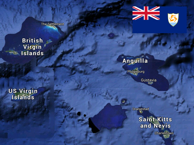
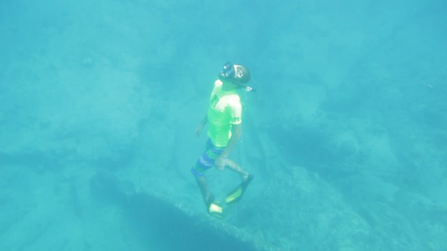
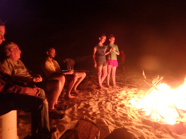
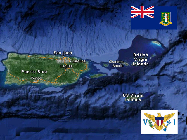
We spent a full month in the British Virgin Islands, and explored as many nooks and crannies as we could. We spent more time sailing our boat in that one month than we usually do in a year, as we crossed and re-crossed the Sir Francis Drake Channel, hopping from one island to another. Our last week was spent in Gorda Sound, where we enjoyed a safari truck excursion all over Virgin Gorda, an adults-only evening out with drinks at Saba Rock and pizza at the Pub at the Bitter End Yacht Club, and Hobie catamaran rentals with the crew of Abby Singer.  We checked out quite easily at Gun Creek and crossed the Anegada passage overnight to Anguilla, where we rest at anchor near Sandy Ground waiting to move south again.

160603_1_6599
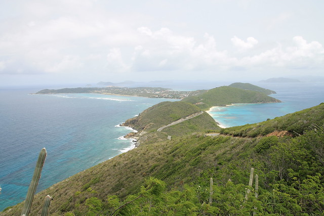
Photo: View from Gorda Peak

160603_1_6580
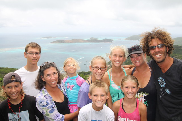
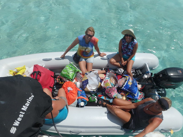
Photo: Take Two + Abby Singer on Safari truck tour

Before we move on, I’ll take this opportunity to share our impressions of the Virgin Islands cruising grounds. If you have ever considered taking a sailing vacation, this seems to be the perfect place for either a crewed or bareboat charter. The place is swarming with Sunsail and Moorings boats, and it’s easy to see why. That said, I think we would have enjoyed the islands more if the anchorages had been populated with cruising boats instead of with vacationing novice-sailors. We are always looking for the quiet anchorage and the private beach, and that was difficult to find (though not impossible) in the Virgin Islands, especially if one cruises in the off-season.

We were also able to complete a couple of major boat projects: a full cockpit enclosure, jib repair, and a new stack-pack for the mainsail, thanks to Bob and Linda Phillips at Doyle Caribbean in Road Town, Tortola. When they said, “It will be done in three weeks,” they meant it! No need to readjust for “island time.” We had been told that Doyle was more expensive, but if time is money, then their punctuality is worth any extra expense. The only minor inconvenience was that we were required to go into Road Town every week for measuring, fitting, and installation, but it gave us an opportunity to re-provision and explore new anchorages. Bob and Linda are sailors and live-aboards themselves, experts who’ve been in the industry for 40 years, and really nice people. If you ever need any work done on sails or canvas, we highly recommend them for their reliability and workmanship.

USVI: St.Thomas and St. John

We stopped for only one night in the rolly anchorage near Charlotte-Amalie, St. Thomas, and then spent several days exploring the little bays on the northwest side of St. John, paying $30/night on National Park mooring balls (no anchoring within park boundaries). Our favorite beach was in Hawksnest Bay, but the quietest, calmest place was Francis Bay, where we had the pleasure of catching up with old friends Ralph and Kathy on s/v Simplicity. One can also hike to an old sugar mill and plantation from there.

IMG_6105
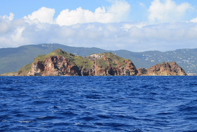
Photo: Entering St.Thomas

BVI: Jost Van Dyke, Little Jost Van Dyke

We checked in at Jost Van Dyke in the British Virgin Islands and had lunch at Foxy’s, before moving around to Little Jost Van Dyke and anchoring near Sandy Spit. We hiked to the Bubbly Pool, where the ocean comes through a crack in the rocks to make a foaming swimming hole, but found that we came at the wrong time. The tide was low, the seas calm, and the bugs out. After swimming in Rachel’s Bubble Bath in Compass Cay in the Bahamas, the Bubbly Pool failed to impress. We did enjoy the one-palm-tree island of Sandy Spit because we had the beach to ourselves at the end of the day.

IMG_6171
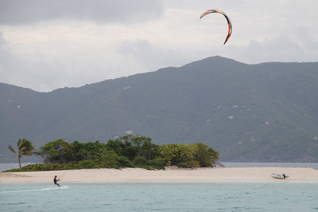
Photo: Andrew kiteboarding near Sandy Spit

Tortola: Cane Garden Bay, Road Town, Brandywine Bay, Trellis Bay, and Great Camanoe

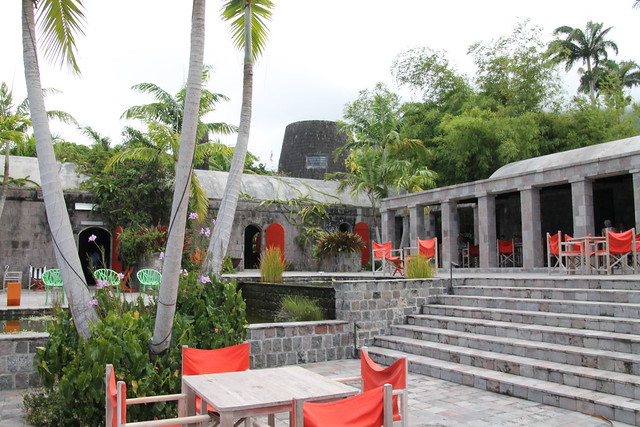
We did not find Tortola to be the charming place we had hoped. After a night in Cane Garden Bay, where the beach is lined with bars and literally a thousand beach chairs (for cruise ship patrons), we sailed around to Road Town Harbor, where we were able to buy groceries at the Rite Way, get a sim card at Digicel, and talk to Doyle about our torn jib. We had no desire to spend a night in the commercial, loud harbor of Road Town, so we anchored in a small, quiet place called Brandywine Bay. There is supposed to be a lovely French restaurant on the hill above the bay, but we never made it. On our other two stops in Road Town to visit Doyle, we spent one night in Trellis Bay, where we enjoyed an evening at the Island Last Resort, and one in Lee Bay in Great Camanoe, a beautiful and quiet place we would visit again.

IMG_6182
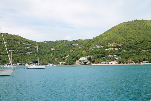
Photo: Cane Garden Bay

160602_1_6556
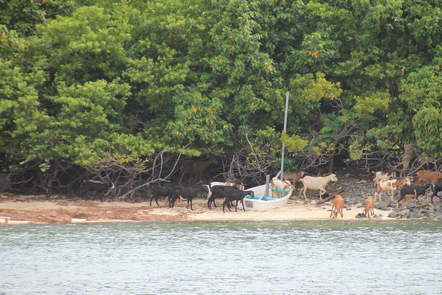
Photo: Brandywine Bay–goat in a boat!

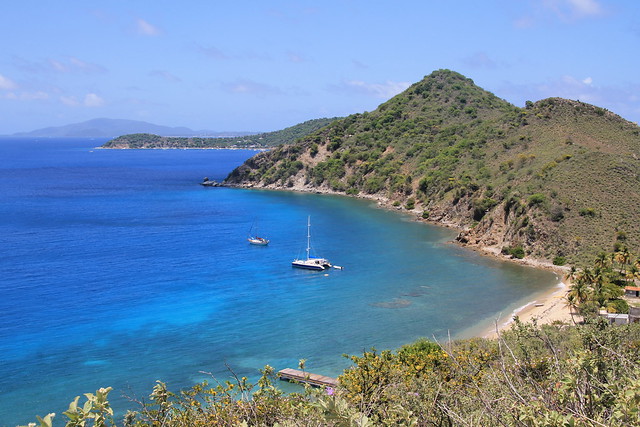
Channel Islands: Norman, Peter, and Salt

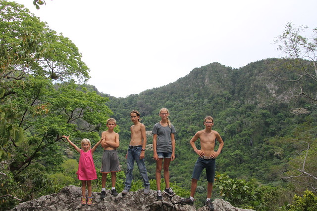
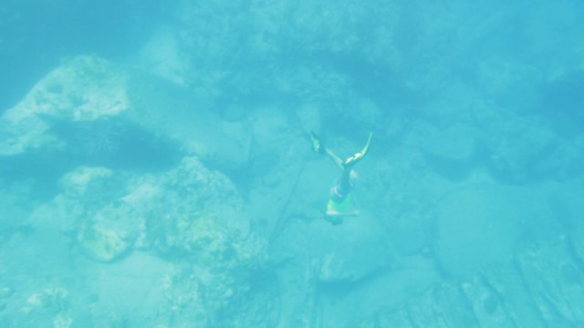
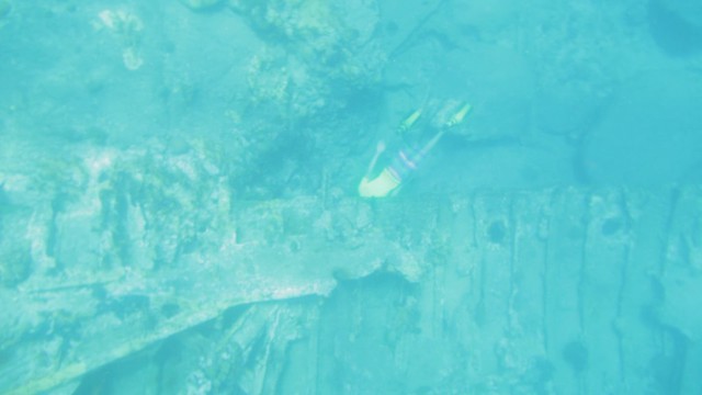
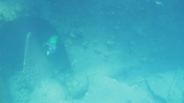
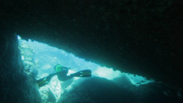
These were easily my favorite part of the BVIs. Norman Island has Privateer Bay, with caves you can swim or kayak in, excellent snorkeling at the Indians, and a beautiful quiet place called Benure’s Bay. Peter Island has two deep bays with good snorkeling and a resort with a gorgeous beach. Salt Island is populated only by goats, but has excellent hiking with breathtaking views and the wreck of the RMS Rhone for a good dive site (see Eli’s post). We spent the night there and had the place to ourselves. We did not stop at Cooper or Ginger Islands.

IMG_6292
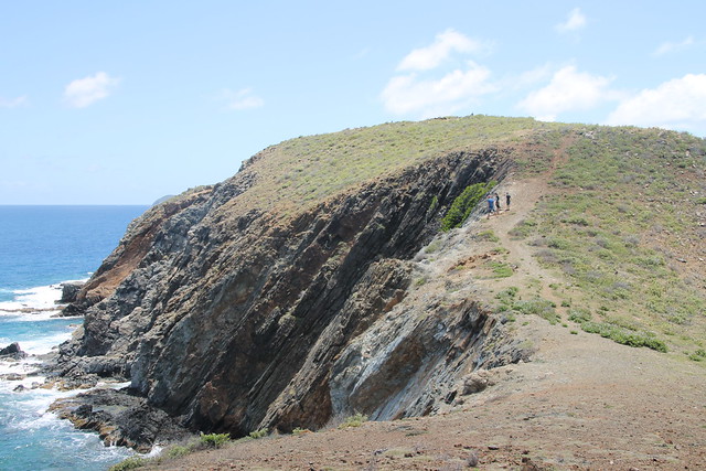
Photo: Hiking on Salt Island

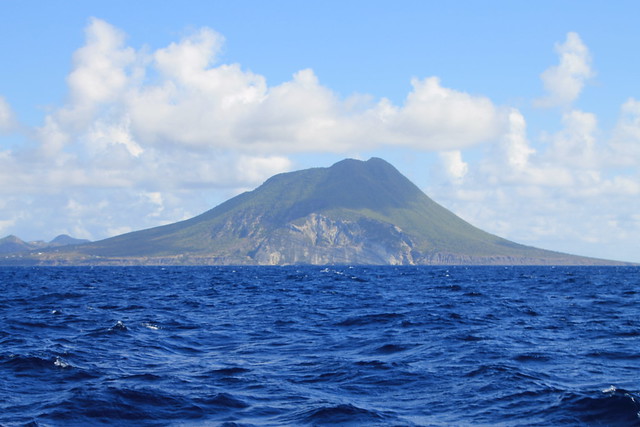
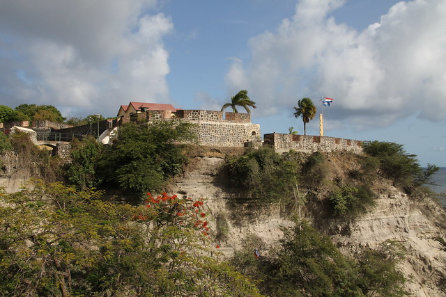
Virgin Gorda: the Baths, Savannah Bay, Prickly Pear, Gorda Sound

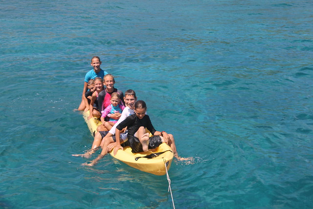
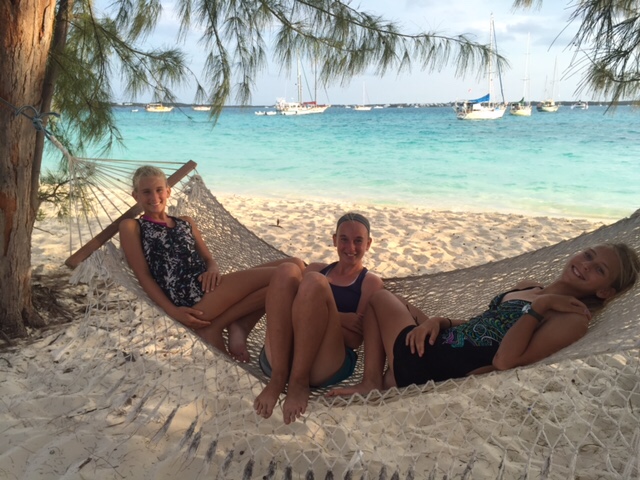
This is a place we could visit again and again. The Baths, with Devil’s Bay to the East and Spring Bay to the West, with their unique boulders and lovely beaches, never grow old. We stopped there three times and would go again. We loved climbing on, jumping off, swimming in the caves made by the gaps in between, and kayaking around and among the giant boulders. We also had lunch at the Top of the Baths, with its swimming pool and great view. Savannah Bay to the West, and Eustacia Sound at the far side of Prickly Pear Island in Gorda Sound are probably our favorite off-the-beaten path anchorages, though we have discovered that deserted places in the BVIs attract clothing-optional charters (see Sam’s post). Gorda Sound is a great place for a date night, small-boat sailing, or hiking to the summit of Gorda Peak for an amazing view. Rada’s restaurant above Leverick Bay is a great local place with reasonably priced food (the home-made Rotis are the best I’ve had).

IMG_6407
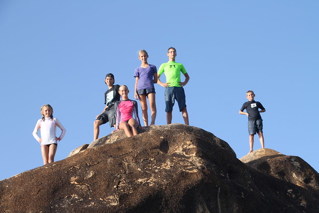
Photo: At the Baths with (left to right) Sky, Aaron, Paige, Sarah, Eli, Sam

Anegada

The sail to and from Anegada was brisk and fun; with a steady breeze of 20-30 knots, we were making 9-10 knots of speed with the jib and reefed main. We found low-lying Anegada to be very similar to the islands of the Bahamas, with its casuarinas, family-run places (Neptune’s Treasure), low scrubby interior, and deserted beaches. Our boys got a chance to do some kiteboarding for the first time, thanks to the patient instruction of our friend Andrew. We spent a couple of afternoons at the Anegada Beach Club (a shuttle ride from the Lobster Trap), a very-cool resort at the end of everything, and well worth the trek.

160531_1_6506
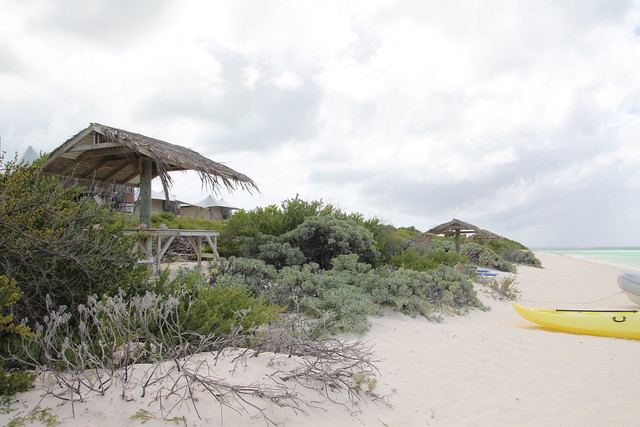
Photo: Anegada Beach Club

160531_1_6518
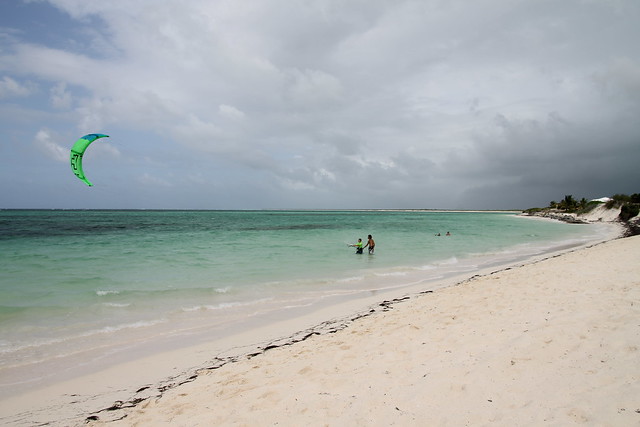
Photo: Eli learning to Kite

Traveling Buddy

“Buddy-boating,” or making plans to travel together, is a common practice among sailing cruisers. On a grand scale, rallies like the Salty Dog, in which dozens of boats leave from Hampton Virginia at the same time each fall bound for the Virgin Islands, are a kind of buddy boating en masse. And on the other end of the spectrum, every year in Marathon, the white board in the boater’s lounge fills up with people looking for someone with whom to cross the Gulf Stream.

There is a myth, I think, with buddy-boating, that there is strength in numbers. While that may be true in bad neighborhoods like the Northeastern coast of Africa, I’m not sure it works on ocean passages, where circumstances that endanger one boat likely endanger another boat that tries to come to the rescue. At best, traveling together offers companionship and someone with whom to celebrate upon arrival. Once reaching the cruising grounds, however, buddy-boating takes on a whole new look. Now a few boats band together and hop islands, chatting on the radio about pot-luck dinner dates and beach days, group-snorkels, and game nights. This is common practice among kid-boats, for obvious reasons. Frequently, the desire to congregate dictates the cruising schedule, and departure decisions are as affected by who’s-going-where as by the weather.

Being free-thinkers and having a large social group of our own (self-sufficient in all things!), we have often avoided this type of groupthink, fearing that we would lose our precious independence or be caught in bad weather by herding from one island to another. At the same time, we are not anti-social, and we love to get together with other boaters, so we frequently find ourselves accidentally travelling with other boats, and surreptitiously hoping to see so-and-so at the next anchorage. I think that has changed in the Virgin Islands.

We are a bit late in the season for a Florida-to-Caribbean run, so we find ourselves more alone than usual. The large group of southward boats we met in George Town seems to have spread out considerably, some stopping in the Dominical Republic for the hurricane season to finish the transit next fall/winter. Others are far ahead of us, well on their way to Grenada, and still others behind us in Puerto Rico. What we find in the cruising grounds here are charter boats—lots of them. With a 7-10 day itinerary, they are on the move, staying one night in each lovely spot before moving on. And so we find ourselves on the slow track with but one other boat: s/v Abby Singer.

IMG_6283

We met Andrew and Summer and their two girls in the Exuma Land and Sea Park in mid-March, and met up with them again around Easter in Black Point, and left George Town on the same day in April. We arrived in St. Thomas the same day in May and have been hanging out off and on since then. They are a delightful family, and we have enjoyed getting to know them. Paige (13) and Sky (10) fit right in with our crew, playing games, doing art projects, jumping off the high dive, and playing music. (They even have dedicated cups that sit in the lineup with the other color-coded kid-cups.) The grown-ups sit in the cockpit and talk boat projects, philosophy, drink recipes, and provisioning. We have dinners together, go snorkeling, play cards, watch movies, go to the beach, and plan excursions. In short, we who have eschewed the practice in the past, are buddy-boating. However, because both Jay and Andrew remain fiercely independent in their decision-making and weather-planning, we frequently leave anchorages on different days, parting ways and rejoining elsewhere, allowing all of us to keep our individuality but also enjoy fun times with friends.

IMG_6263


The Wreck of the Rhone

Over the course of our family’s snorkeling career, we have dived on the wrecks of several planes and ships. The most recent of these is the wreck of the RMS Rhone. The Royal Mail Ship Rhone sank off of Salt Island, BVI, in 1868 during a hurricane. Another mail ship, the Conway, also sank in Drake Chanel in the same hurricane.

As it sank, the metal steamship broke into two sections. The bow section fell in 80 feet of water, and is largely intact. The stern section sank closer to shore, in 25 to 70 feet of water, and broke into even more chunks. The largest piece, the very rear of the ship, is in 30 to 45 feet. Clearly visible in the wreckage is the gear box, drive shaft, rudder, and huge bronze propeller.

We were anchored nearby, and decided to check it out. We dinghied out to the wreck, laden with snorkel gear, and tied up at one of the numerous moorings over the area. We were joined by some friends on Abby Singer, who also wanted to see the wreck. We swam towards the buoy, looking for the debris of the sunken ship. We found nothing but rocks and a school of squid. It wasn’t until an enterprising young diver (me) decided to search in the other direction, did we find the stern chunk.

I made several dives over the main section, looking for the captain’s silver tea spoon, which was, according to our diving guide, resting on the gearbox. Unfortunately, I never found it, but I did find a large number of colorful corals and reef fish. I swam on to view other pieces of the wreckage, including the ship’s disco (with checkered tile floor intact), and the engine. The side of the engine was laid bare, revealing the barnacle-encrusted crankshaft and pistons as large as myself. It was weird to imagine that these rusted and overgrown pieces of machinery once operated smoothly.

The coolest thing though, was the prop cavity. Twenty feet deep, the area where the broken propeller used to spin left a cave that led under the hull and out the other side. The inside was coated in a dense layer of multi-colored sponges. There were also large schools of little brown fish with forked tails and bulging eyes, and five or six grouper.

I swam down and inspected it, weighing my odds of success if I went through. It wasn’t that far to the other side, only 15 feet or so, an easy distance (for me). But what if I can’t hold my breath long enough… Nah, I’ll be fine. I swam in. It was weird, the minute I went underneath the hull, the urge to breathe lessened, allowing me to leisurely swim through the prop cavity and up to the surface. I made several such dives. I don’t know why it’s so fun to swim under things, but I sure get a kick out of it!

The next day, Andrew on Abby Singer and I went back to the wreck, him because he wanted to get video footage of the ship, and me because I always want to go snorkeling. I swam through the tunnel a few times, and once again searched in vain for the Mystic Spoon. This second trip to the wreck no-doubt contributed to my advanced condition of TMF (Too Much Fun), but it was so worth it. The Rhone was even better the second time! Visiting it was one of the coolest snorkeling trips ever.

Rhone 1

Rhone 2

Rhone 3

Rhone 4

Rhone 5

Nudey Booty

We anchored in Pond Bay in Virgin Gorda. Fortunately, it had nice beaches. Unfortunately, there were nudists on the beach in front of us. Fortunately, there were two beaches. Unfortunately, we had to dinghy past the nudists on the way to the other beach. Fortunately, they were behind a bush. Unfortunately, the bush was small. Fortunately they were far away, and fortunately I had a great time at the beach. Unfortunately (or fortunately?), we didn’t take any pictures that day.

Full Circle

We spent Christmas Eve 2014 with our friends Kimberly, Michael, and Ally on their 34’ Gemini catamaran Ally Cat. This was special for two reasons: one, a family of seven almost never gets invited onto someone else’s boat for a meal, and two, these are good friends we met at the Capital Yacht Club in Washington DC that September, and we didn’t know when we would see them again. They were on their way to the Caribbean, and for the couple of weeks they were with us in Florida, it was wonderful.

With the crew of Ally Cat, we had traipsed all over Washington DC on field trips to museums and memorials. We set out every morning, walking down L’Enfant Plaza with our combined six, singing like the Von Trapps on an excursion. Ally is a bright girl who loves to play games, make music, and do art projects—a perfect companion for Sarah. Together, they colored mandalas, played jacks and mancala and backgammon and cards by the hour, and played music together and laughed and talked.

At Christmastime, Ally blended in seamlessly with our family as her parents provisioned, cleaned, and repaired their boat for the trip across the Gulf Stream and into the Caribbean.  We baked and frosted cookies and made Christmas decorations and sang carols. We did a girls’ outing to see the Nutcracker. And on Christmas Eve, we all crowded onto their boat for bowls of steaming tortilla soup and homemade cornbread. A few days later, they were gone, and little pieces of our hearts with them.

Sarah and Ally

Nutcracker

Some friends we meet at the beginning of their journey, others we meet at the end, on their way back to a land-life. Occasionally, we get to travel for a while with another family and become especially close. We treasure them all and what they have added to our cruising life. It was bittersweet when Ally Cat set off—we were happy to see them sail toward a distant horizon, and sad that we were staying behind to re-rig Take Two instead of cruising together.

One can imagine my delight as we watched the tracks on our Inreach devices slowly converging in the Bahamas this spring. I couldn’t wait to hear about Ally Cat’s cruising experiences, and Kimberly and Michael were looking forward to some fun in the Bahamas with old friends. The tracks finally crossed the first week of April. We had caught a Mahi on the way to George Town, and we shared fish tacos that night aboard Take Two and got caught up. While we were there, we had a beach day near Chat n’ Chill, letting the kids swing through the trees while the grown-ups chatted in the shade.

160404_6_0001

We did a mom’s day out provisioning in George Town, with four boat moms and all their groceries aboard Take Two’s 13-foot inflatable!

160405_6_0018

Rachel got her “date” with Kimberly aboard Ally Cat while Sarah had girl time of her own with friends and the boys and their friends hiked up Monument Hill. We shared a beach fire (and s’mores) with Ally Cat and Abby Singer, sang and played ukulele together at the St. Francis resort cruiser’s music night, and spent a day taking copious notes on their trip through the Caribbean.

Beach Fire

And now, we have come full circle. I sat with Kimberly and gave her my notes and cruising guides for the Bahamas before their trip, and she has returned the favor. We find ourselves visiting beautiful places I had read about on Ally Cat’s blog, using notes I took from Kimberly’s trip to find good spots to anchor or kayak, and generally taking a little piece of our friends with us on our trip. This is what is best and worst about our transient way of life: time with friends is often short, but there’s always the promise of meeting up in beautiful places somewhere down the path.

Geography Report: The Virgin Islands

VirginsMapFlag

Basic Facts

Islands belonging to the US: St. John, St. Thomas, St. Croix
Islands belonging to the UK: Tortola, The Channel Islands, Virgin Gorda, Anegada, Jost Van Dyke
People/Customs: The islands are populated with the descendants of freed slaves. They are a tourist destination, especially for people chartering sailboats. All vehicles are driven on the left side of the road in the BVI.
Language: English
Climate: Rainy season (and hurricanes) from June to November, Dry Season December to May. Trade winds (prevailing from the East) all year, but heavier in the fall and winter and calmer in the spring and early summer.
Food/Farming: Sugar cane, tobacco, chickens, and tropical fruit like passion fruit, sugar apples, star fruit, mangoes, guava, papaya, soursop, yenip, sea grapes, tamarind, and goose berries.
Government: USVI are Non-Self-Governing territories purchased from the Kingdom of Denmark, BVI are Overseas British Territories, though not part of the European Union.
Currency: U.S. dollars accepted everywhere
Art/Music/Culture: Popular music and dance in the Virgin Islands are heritage dances, calypso, reggae, salsa, soca, and hip-hop; culture has influences from the French, Dutch, African, American, Danish, and Indian people.

History

The first inhabitants of the Virgin Islands were the native Ciboney, Arawak, and Carib tribes. The Carib people were cannibalistic, and were avoided and feared by the other tribes. Some words adapted from the Native American languages were canoe, tobacco, barbecue, potato, hurricane, and cannibal. Christopher Columbus discovered these islands in 1493 on his second voyage to the new world. He claimed the islands for Portugal, and seeing how many there were, named them for the martyred St. Ursula and the 11,000 virgins. From Columbus’ vantage point on the water, one island may have looked like a fat woman, earning it the name Virgin Gorda.

As more people came to the Virgin Islands, theft, smuggling, and piracy evolved. All were after a piece of Spain’s wealth, mostly gold taken from South and Central America. Sir Walter Raleigh raided Spanish settlements, and the channel south of Tortola is named for his cousin, the famous explorer/privateer Sir Francis Drake. Infamous pirates who roamed the waters of the Virgin Islands include Henry Morgan, Calico Jack and Anne Bonny, Bartholomew Roberts, and Edward Teach (Blackbeard).

As population increased, the Carib natives became more of a problem for the obvious reasons of their love for fighting and cannibalism. There was contention up until the 19th century, when there was a small war between the Caribs and the British. The natives, unable to form a sustainable slave labor force, were replaced with slaves imported from Africa, who harvested sugar cane for export and rum production. To this day, the inhabitants of the islands are primarily the descendants of freed slaves.

European nations were not the only ones interested in the Virgin Islands, however. Wanting them for military outposts to keep an eye on the passages to the Panama Canal and North America, The United States bought St. John, St. Thomas, and St. Croix from Denmark for $25,000,000 in 1917. The teetering island economy began to get stronger in the beginning of the 20th century with the tourist influx brought by the good weather and beautiful water. With the help of the charter-boat industry, marinas, and resorts, the Virgin Islands are now a major vacation hot-spot.

Land Forms/Flora and Fauna

The highest point is Crown Mountain, at 1,552 feet in St. Thomas; the lowest island is Anegada to the north. There is some tropical rain forest scattered throughout the islands. Many kinds of tropical fruit grow on the trees. The islands are home to many species of sea birds, tropical fish, coral, sharks, crustaceans, and turtles.

Things to do

Tortola has the Trellis Bay full-moon party, Mount Healthy hike, Bluewater Divers for diving reefs and wrecks, and Cane Garden Bay for beach and restaurants. In the Channel Islands, Salt Island has salt ponds and the Wreck of the Rhone, Norman Island has caves, Peter Island has beaches and snorkeling. Virgin Gorda has the Baths (unusual rock formations) and a sheltered bay to the north. Jost Van Dyke has The Bubbly Pool and Sandy Spit. St. John has the Coral Reef National Monument and the Annaberg Sugar Plantation. Charlotte Amalie in St. Thomas has shopping and Fort Christian.

Bibliography

Scott, Nancy and Simon. The Cruising Guide to the Virgin Islands, 17th Ed. 2014: Cruising Guide Publications, Dunedin, FL.

Bio Bay

We have finally left Palmas del Mar marina in Puerto Rico, where we had been staying for the last three weeks. We took the first weather window after ten days of rain and squalls to motor to Vieques in the nearby Spanish Virgin Islands. The passage was rough, but fortunately short, only a few hours long. We dropped anchor in a creek leading to Puerto Mosquito, also called Bio Bay (so called because it is supposedly the bioluminescent capital of the world).

We waited until the night was sufficiently black, and then kayaked down the creek into the bay. Even in the creek, our paddle strokes created small swirls of light. Pretty good by our standards, but that was nothing, nothing, compared to what we found inside the bay. It was like we had crossed a magic line. The minute we entered the bay, the bioluminescence was multiplied a million-fold. The slightest motion evinced huge scintillating clouds of green light. It was most excellent.

I was dared by a certain reader to do two things: to jump into La Mina falls in El Yunque rain forest (man, that water was cold), and to swim in Bio Bay. We have now done both. Needless to say, I was the first one in the water. Despite what I expected, it was not creepy to slide into the pitch black water, but exhilarating. Each movement turned the water around me into green fire.

During the day, Puerto Mosquito is calm, shallow, and very murky. In other words, it’s your typical mangrove bay. The bay provides sanctuary for a number of species, such as pelicans, snook, mullet, mangrove cuckoo, herons, and rays. But by far the most well-known inhabitant of Bio Bay is Pyrodinium bahamense. It is a unicellular plankton with two whip-like tails, called flagella, that aid in movement. When agitated, this tiny life form emits a bright green flash of light, creating the glow in the water known as bioluminescence.

We have noticed bioluminescence in our wake before, but never in this volume. The reason for this concentration of glowing dinoflagellates results from several factors, which have conspired to create the perfect environment. Such factors include salinity, water depth and temperature, solar radiation, and slow circulation. The underwater fireflies have taken advantage of these perfect conditions, and multiplied. There are over 600,000 organisms in just one gallon of water.

After swimming for almost an hour, we got back in the kayaks, and paddled slowly home, some of the bioluminescence still clinging to our skin. It was one of the coolest experiences we have had on this trip, and certainly was the best night swim ever!

El Yunque National Forest

El Yunque

Last week we hiked on El Yunque Mountain on the eastern side of Puerto Rico. El Yunque National Forest is the only tropical rain forest in the U.S. park system. We hiked down La Mina River trail and climbed on rocks and fallen logs in the river. At the end of the trail we swam in the pools of the waterfall, which were surprisingly cold. Then we hiked back up the hundreds of stairs to the road that led to the car. It was a great day and I highly suggest visiting the park if you are ever in Puerto Rico.

La Mina Falls

Photo by Mary