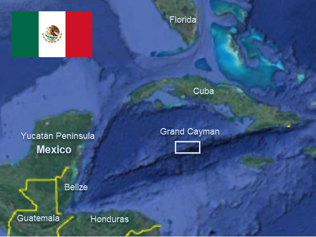
The following post is part of a senior project Sam completed for his high school diploma. He and Eli hiked over 1100 miles on the Florida Trail from Ochopee in Big Cypress to Fort Pickens in Pensacola Beach January 12 to March 24, 2025.

The Florida Trail (FT) is one of eleven National Scenic Trails in the United States. It starts in Big Cypress National Preserve and runs north through the peninsula of Florida and west through the panhandle, ending on Pensacola Beach near the Alabama border. With over 1300 miles of trail, hikers pass through many of Florida’s unique and diverse natural landscapes including swamps, hardwood forests, prairies, and pine scrub, and alongside rivers, lakes, freshwater springs, and beaches. My oldest brother Eli and I first discovered the trail on a weekend camping trip in February of 2024 in Ocala National Forest, as we were trying to spend more time outside. We stumbled across the FT because it runs right past Alexander Springs, where we saw a trailhead and a map. The idea of hiking with just the bare necessities across the whole state sounded like the challenging adventure we were looking for. We both ruminated on the idea for a while before fully committing to it in September of 2024, allowing us five months to prepare for a departure in January of 2025, when the weather would be the most agreeable.
Planning, Preparation, and Gear
I spent a lot of time watching YouTube videos on thru-hiking and acquiring the necessary gear. I learned that an average of eighteen miles a day was a reasonably achievable goal for healthy individuals on good trail conditions, so we formed the expectation of completing the trail within sixty hiking days. To plan and execute our trip, we used Far Out, a navigation app with the necessary information about water sources and camp sites on the trail. Eli also carried a Zoleo satellite communicator for emergencies and to allow family to track our location. Food could be acquired in towns along the trail every two to five days, each day’s worth of food weighing about three and a half pounds. The trip revolved around resupply locations; we carried only what we needed to get from one store to the next to keep the weight of our packs as low as possible. We each carried three one-liter water bottles, a water filter, and a single two-liter water bag to aid in gathering and filtration or to provide additional storage. We could get water from streams, lakes, swamps, or unguarded water faucets in rural areas. A general rule of thumb is that you need one liter of water for every five miles and one and a half liters for a night without a water source. Due to frequent water sources and favorable weather and trail conditions on the FT, we rarely carried more than two liters per person. I learned that most acceptable gear is pretty expensive; however, many things can be shared to cut cost and weight (a tent being the most expensive and heaviest shareable item), but that it’s better not to go cheap on important things like backpacks, shoes, or sleep systems, as those are the things on which you rely most. But little things like waterproof backpack liners can be replaced with trash bags. Overall, any hiking gear can only satisfy two of these three criteria: affordable, high quality, and lightweight.
The Hike
In hindsight, I can break the trip roughly into thirds, three distinct phases one might categorize as Acclimation, Enjoyment, and Mastery.

Phase One: Acclimation
Because we had never done anything like this before and had barely broken in our gear, the first phase represented a big adjustment period. We had a lot of learning to do, and we constantly experienced aches and pains. We learned what foods we did and didn’t like, what time we liked to get up and how to efficiently plan around food and water. We also learned what gear was good and what was unnecessary. For example, our tent poles had a serious issue that required us to jury-rig our tent until we could replace it in the first major city. I also figured out early on that the comfort of warm food was not worth the weight of a cook-system, so I ditched the burner, titanium pot, and fuel cartridges and resorted to the common thru-hiking tactic of “cold soaking” foods like instant oatmeal or mashed potatoes.

Our parents dropped us off at the trail head near the Oasis Visitor Center in Big Cypress National Preserve. The first two days we trekked through the Everglades between US 41 and I-75 in a mix of ankle-to-knee-deep water in cypress swamps, across large pine and palmetto islands, and through dry rocky marshes. Crossing I-75 northward, the trail passes through the Seminole Indian Reservation for a full day’s hike before entering the South Florida Water Management Area. There was a church that ran a hiker ministry, providing the only location to camp within the Indian Reservation; it was here where we met some other hikers: a pair of middle age women called “Boston” and “Cubby,” an experienced hiker called “Ice Man,” and man in his sixties on his first thru-hike nicknamed “Father Tom.” I would become friends with Father Tom as our paths crossed a few times along the trail, and I still maintain contact with him. It was here that Eli and I also received a sort of joint trail name, “The Boat Brothers,” from Boston and Cubby, whom my parents had met at the trail head and chatted up.

From the Indian Reservation we walked straight onto the levees that run northward through the South Florida Water Management Area. In this section, we spent days walking in straight lines on top of 20ft-tall levees with gator-filled canals on either side for as far as the eye could see. I had set a goal for myself on this trip to avoid digital media distraction and entertainment (like music, audiobooks, or podcasts), but by the end of this section it became apparent that this goal was not reasonable or attainable for me. The hours seemed to drag on endlessly and I began to feel extremely bored and agitated. It also became increasingly difficult not to focus on the discomfort of foot pain. The harsh pavement and gravel roads we had been walking on began to take their toll on our feet, causing them to become increasingly tender as we progressed. This was a constant inconvenience to which we later became accustomed, but for the first three weeks it was the primary challenge. Listening to music, books, and podcasts made the miles more bearable.

After a Walmart resupply and a night in a shabby hotel in Clewiston, also known as “Americas Sweetest Town” because of its sugar production, we spent the next three days walking around the west side of Lake Okeechobee and into Okeechobee City. North of Okeechobee we walked on roads and trails along the Kissimmee River, through pastureland, oak hammocks, sandy pine forests, oak and palm forests, and across large palmetto prairies. We resupplied at occasional small-town convenience stores.

One such resupply location was 10 miles off-trail by road; it was the only substantial resupply in a 160-mile stretch and we didn’t feel like carrying upwards of eight days’ worth of food (more than 25 pounds). The resupply point was a well-stocked convenience store where we could get our phones and batteries charged, but that’s where the benefits ended. There were no campsites nearby, no vacancy at the only motel where we had hoped to stay, and the day was getting late. It seemed as if we would be spending the night under a streetlight at the edge of town. Right as we were cracking open our sad little cold-soaked dinners at the outdoor picnic table, we were approached by an older fellow who was curious about what we were doing. His name was Doug Adams, and we had a pleasant exchange of stories. When he asked where we were planning to stay the night, we told him; he deemed our plan unacceptable and invited us to his home for dinner and offered us his front yard to pitch our tent in. We had a lovely time chatting over dinner on the porch of his home with him, his wife, and some other guests he had over. He was a very talkative guy, intrigued about our upbringing on a sailboat, and loved telling us about his early life adventures. In the morning, he was happy to give us a ride back to the trailhead. Through this experience I learned that being polite, personable, and interesting can get you a long way, and that God will put the right people in your path when your plan sucks.

Toward the end of this stage in our hike, we stayed a night at another hiker-friendly church where we reunited with a few of the hikers that we had met along the way. We also met “Brushy Burt” for the first time; he was an old-school hiker who was on his third hike of the FT and who had allegedly chosen the swamp over his marriage. He had a wealth of knowledge on flora, fauna, and wilderness survival which he loved to share. Brushy Burt was my favorite character that we got to know. At the end of Phase 1, my parents and two of my siblings drove to Orlando the first weekend of February to pick us up. We spent a few days at an Airbnb house in Oveido where we could celebrate my 18th birthday and enjoy the comfort of hot showers, soft beds, real food, and clean laundry, ending what I hoped would be the toughest part of our journey.

Phase Two: Enjoyment
Unfortunately, that hope was quickly crushed. In the last 100 miles or so of Phase One, I had been developing some odd blisters on the tops of my toes, but they were only a painful inconvenience. On the first night after leaving the comfy Airbnb, I developed a high fever and intense nausea and ended up needing to spend the following day and night resting in a hotel near the urban trail before moving on. After the rest, I felt confident enough to keep moving but later I would realize that my blisters and fever had been symptoms of a systemic staph infection. Otherwise, this phase was more pleasant than the last. Miles were passing more easily and we were able to just enjoy the beauty of the state.

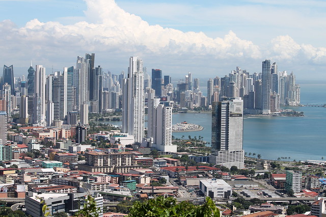
After leaving the Orlando area it was a relief to be back in the wilderness. In Ocala, we appreciated the forests, springs, and lakes of Central Florida with minimal road walking. In Northeast Florida, the trail passed through rural areas with periods of forest trail in between. Around the half-way mark (mile 550), I intended to replace my shoes via delivery from home. However, the box was running four days late thanks to a holiday and the U.S. Postal Service. We could’ve re-routed the package to the next town, but we were close to a hiker-friendly place called the Center for Peace and Justice (CPJ) and where we had already stayed one night. The CPJ had a kitchen, books, games, and beds available to hikers willing to contribute thirty bucks and a helping hand. We decided to wait for the package there, and spent four days playing board games, cooking, doing chores, and resting; the location for an unplanned delay couldn’t have been better.

Rested and with my new pair of shoes, we left the CPJ and entered Osceola National Forest. The weather was cold and dreary, but there was beauty in it. That also meant we didn’t have to carry much water. The trail was partially flooded and ran through a long-leaf pine forest with low palmetto brush. Some of the deeper sections of trail had picturesque little boardwalks. After Osceola, we encountered the Suwannee River in all its glory, right at some rapids. In the beginning, this section was amazing, containing one of my favorite trail days, but the novelty of walking along the riverbank wore off. In addition, we encountered a long part of hurricane-damaged trail along the river and the going became very slow.

After the trail departs from the Suwanee River, it enters the Big Bend area of Florida, heading west for more than 70 miles along roads through rural Florida. After that we hiked along a subterranean river for a day and then spent a night behind some gas tanks at a convenience store. It was around this time that I noticed the resurgence of the blisters on the tops of my toes. The next day we entered the marshland of St. Marks Wildlife Refuge, walking on top of short levees before entering the historic town of St. Marks, where we spent the night (behind a much less sketchy convenience store).
The next morning in St. Marks I woke up with the blisters on my feet worse but decided to walk anyway, booking a hotel in the next town hoping that I would be able to wash, rest, and recover. Up until this point, most of my injuries would heal or improve with just a bit of rest. But this time, things got worse instead of better. The following morning, I had more blisters, local swelling, and I also felt lethargic. We were in a town along State Road 98 and needed to do a large resupply before continuing. But I was now limping badly, and it became apparent in the afternoon that I would not be able to go on without an improvement in my condition; I was developing a fever again and showing the same symptoms of systemic infection as I had before.

Staying optimistic, thinking that a couple of “zero days” would resolve the issue, we booked a night at the local state park and took an Uber there. That night, while we were setting up our tent in light wind, the joint where the aluminum tent poles meet unexpectedly snapped. We got another night at the campsite and tried to repair it with JB Weld, which did not work. That failure, combined with the condition of my feet, made it apparent that we couldn’t keep going. Out of options, we got in contact with our parents. It turned out that Mom had some friends from the Keys (Alex and Josh Mann) who had started a homestead in the Big Bend area, and who had offered to help us out. Josh was able to pick us up that very day. We stayed in an RV on their property for four days. In that time, they provided us with real food and fellowship. Eli was able to be helpful and clear some land around the property with Josh. He also got a ride into Tallahassee with Alex to buy a new tent. My blisters cleared up with disinfectant, salve, and rest. Overall, the Manns were extremely hospitable and salvaged what seemed to be an adventure-ending series of unfortunate events. Through this experience, I learned the value of building and maintaining connections: one day networking might save your ass.

Phase Three: Mastery
Phase three represented the mastery of our daily routine and planning. We had become acclimated to the lifestyle of hiking bums and remained mostly pain-free for the rest of the trip, allowing us to be more confident and relaxed. For those reasons, this phase of the trip was my favorite. The landscape was, on average, much drier with some gradual altitude variation, and we even occasionally saw the horizon from hilltops. But before we could climb to any hilltops, we first had to pass through the Apalachicola National Forest, which contained the final swamp section.

Josh Mann dropped Eli and me off at a trail head on the side of the road about a day’s hike from the final swamp section. Little did we know that we were beginning the most challenging few days of the trip. It had been raining for some time and was forecasted to continue raining for the next few days. So, the trail was wet and our gear became water-logged. I had spent nearly a week off my feet, so the miles weren’t passing as easily as before. And at night, the heavy rain knocked the condensation off the inside of our tent, preventing us from getting any good sleep and wetting our remaining “dry stuff.” Despite these unpleasant conditions, the actual trail was beautiful, the swamp was deep, and I remember this section as one of my favorites. We were in and out of the most intense segment of swamp, Bradwell Bay, by the end of the second day back on trail, but we had nothing dry left.

After waking up in a flooded campsite and walking through some drizzle, the sun came out for a couple hours, and we were able to somewhat dry our stuff at a trailhead. We also found Brushy Burt doing the same, and we hung out with him and ate our lunches. Afterwards we kept moving, walking through sections of flooded pine forests and through short but very deep parts of the Titi swamp. Our planned campsite turned out not to be viable, forcing us to hike into the night. The pinnacle of suck occurred after sundown when we discovered that we weren’t finished with the Titi swamps and would be walking through them in darkness. But we had a moment of hilarity when standing shin-deep in muddy water, looking into the creepy darkness of the swamp ahead. We turned to each other and laughed at the absurdity of the situation, because that’s all we could do. That night we completed that section of trail and camped in a nice little trailhead parking lot. But I remember that very unpleasant experience fondly because we chose to respond with humor.

The next day was long, but we completed the last swamp section of the FT and never got our socks and shoes wet again. In the Central Panhandle region, we passed through more than one hundred miles of a mixture of hilly forests and rural roads through small towns. Into the western end of the Panhandle, the trail primarily runs through Eglin Air Force Base, a well-maintained section with frequent campsites, crystal clear streams, and the constant sound of fighter jets and attackers conducting all sorts of light and munitions exercises.

After exiting the southwestern end of the Air Force base, we passed through a small town and over a large bridge, onto the home stretch of barrier islands. We walked through the overpopulated beach tourism zone of Santa Rosa Island before entering a long stretch of sand dunes, the nesting grounds for multiple protected bird species. We walked along the beach for a couple of miles but otherwise the trail just followed the road that went the length of the barrier island.

We spent our last night camped amidst the sand dunes, probably one of the worst campsites of the entire trip due to the biting no-see-ums. And the next morning, on March 24th, we walked through Pensacola Beach and rather anti-climactically found the Northern Terminus: a broken brick monument at Fort Pickens. It had taken us 71 days to walk 1111.5 miles of trail.

Our parents, accompanied by Rachel, had spent the previous day and a half driving up to meet us at Fort Pickens and provide transportation back home. They had begun doing some camping excursions of their own, out of the back of the Suburban, in the Everglades/Big Cypress area and were excited to come do some camping with us. We spent the night at the Fort Pickens campsite and enjoyed showers and hot food. The next morning, we had eggs, bacon, pancakes, and hot coffee (thanks to mother!) before getting on the road. We stopped again to camp that night, revisiting a previous stop on the Florida Trail, Mike Roess Gold Head Branch State Park, where we enjoyed all the comforts of car camping again. The next day, we arrived back in Naples. It was certainly strange to be back home in a fraction of the time it had taken us to hike the same distance.

Conclusion
When I committed to hiking the Florida Trail, I wasn’t looking for a journey of enlightenment—just a good adventure. But I ended up learning a lot about myself and how to respond, both physically and mentally, to discomfort and stressful challenges—and how not to respond to them. I say that now because, looking back, I was often more focused on hitting a specific mileage or keeping a routine than on adapting and taking things less seriously. That mindset led to mental fatigue and discouragement whenever things went “wrong.” In the final third of the trail, I recognized and began to correct that inflexible attitude, adopting a more relaxed stance, which greatly improved my experience.
I found that I didn’t miss many of the comforts modern society provides—except for hygiene and good food—those were the greatest sacrifices. I learned that the human body is amazing; its capacity to adapt and heal when conditions drastically change is incredible. On trail, I would often go to bed with terrible aches or minor injuries, unsure about being able to get up and walk the next day, only to wake up in the morning surprisingly capable of doing so. I learned that whether a day feels good or bad depends more on the progress made toward a goal than on the discomfort or difficulty experienced along the way. This leads me to believe that the answer to living a fulfilling life lies not in the acquisition of great wealth and many comforts, but in making progress and having a sense of purpose, as well as in growing the relationships with those alongside whom you literally or figuratively walk. Though I likely won’t return to thru-hiking beyond short trips for my own enjoyment, I know I’ll continue to face many of the same mental and physical challenges in other areas of life. And I know that I am now more equipped to handle life’s inevitable obstacles.

Gear List
- 50L ultralight framed backpack
- 2L waterproof fanny pack
- Bear proof food bag + a scent proof plastic bag
- 20-degree ultralight quilt
- Insulated air mat
- Folding insulated foam pad
- A 2 person tent
- Salomon trail runners
- Collapsable trekking poles
- 2L water bag
- Sawyer water filter
- 2x 1L plastic water bottles
- Electronics” Night Core headlamp, 10 Ah battery, 50W charger, charging cables,
- Bear spray (Eli carried the sat device)
- Hygiene/toiletries: Titanium trowel, minimalist toiletries, soap.
- First aid for minor injuries and a compression wrap.
- Repair stuff for air mat punctures and tent tears.
- Titanium spoon and ice cream container for eating.
- Cotton tea towel for cleaning off before bed.
- Trash bags for waterproofing
Clothing:
- Frog Togs rain jacket
- Decathlon down jacket
- Terrex lightweight fleece jacket
- Light Merino wool T-shirt
- Sun hoodie
- Merino wool Buff
- Boonie Hat
- Pit Vipers
- 1 pair of Merino Wool underwear and a backup pair of cotton
- Merino wool leggings
- 1 pair of Sports shorts
- 2 pairs of Silver Light Merino wool long socks
Total dry weight: 12 pounds
Total with 5 days food and 2L water: 32 pounds