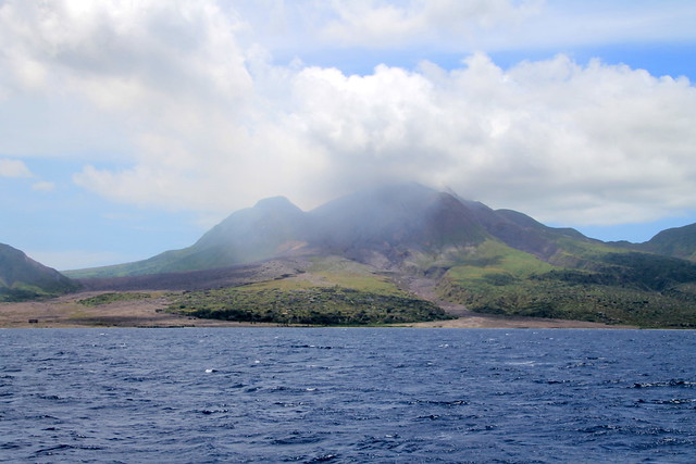
Picture this: you’re sailing into a harbor of an island nation you’ve never visited before, after a rough day at sea, furling sails, starting engines, and preparing bridles for anchoring or mooring, and a small, multi-colored, wooden fishing boat comes roaring towards you. He comes alarmingly close, does a swift U-turn, then starts shouting at you in heavily-accented English. The first time this happens, you feel a little freaked out…are these the famous Pirates of the Caribbean? But by your third or fourth island with a welcoming committee, you begin to grow savvy, then you get a little jaded. Eventually, you learn to wave, ask the name of the captain, and tell him to come back after you’re anchored, and no, you do not need assistance. Really, no. No, thank you. (No, dammit!)
These are the Boat Boys. Enterprising, opportunistic, and insistent, they are like humane-society pets: one look at those sad eyes and you can’t figure out which one to take home and which one to leave behind. It doesn’t matter how many carved-coconut bracelets you have bought, how many soursops, sugar-apples, and bananas you already have going soft in your fruit bowl, there will always be one more Boat Boy calling your name: “Hey, lady! Nice lady!” “Madame, I have something for you.” “My friend, take a look at what I brought you today!” “Fresh fish!” “Fresh fruit!” “Fresh bread!”
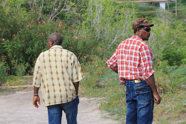
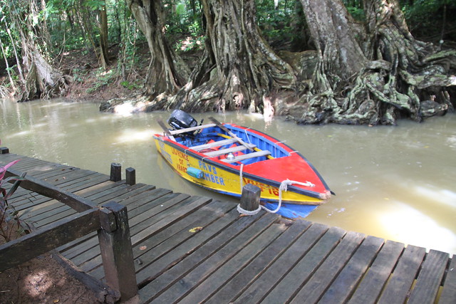
They come in crafts of all sizes and materials: cast-off paddleboards, patched inflatables, locally-built pirogues with fast outboards, leaky rowboats with two-by-fours for oars. Some of them are Rastafari, and go by names like “Warrior” and “Culture.” Others have nicknames like “Beans” (as in “full of”) and “Skipper.” Others are regular guys, just trying to survive and support themselves and their families, like Justin, who works the charter boats to earn enough money to buy his daughters’ school uniforms. Some of them, like Titus, have traveled the world and come back to their island-homes, and others have never been to the island a stone’s throw away. Some of them, like “Lawrence of Arabia,” are part of a boat-boy association, a way of sharing the wealth and taking turns welcoming boats. Occasionally, they are obnoxious and get in the way while you are trying to anchor, or actually bump into your boat, or continue their sales pitch after you’ve said “no thank you.” A few are little better than beggars.
You pay them too much and they throw in extra produce “as a gift” and they invariably ask for a cold drink, a beer if you have one, or soda or juice if you don’t. They’ll take your garbage for a small fee (you should refuse because you don’t know where that trash will end up), and they’ll sometimes ask if you have used items you’re ready to part with, clothes in good condition, shoes, or household goods. All of them are trying to make an honest living, something that can be hard on an island in the tourist off-season, or a place hard-hit by a natural disaster, or a village with a high-unemployment rate. They are often relying on multiple revenue streams—picking up odd jobs, fishing, or operating as a water-taxi in addition to selling fruit or hand-made crafts. It is what they are not doing that strikes me as important: stealing, begging, or selling drugs.
You can send them away, and they will reluctantly paddle or motor to the next boat, or you can look at their wares. But if you seem even slightly sympathetic, watch out! They can smell a sucker from the next harbor. There is another thing you can do: sit down on your stern, hold their dock lines, and talk. You will often find them to be floating philosophers.
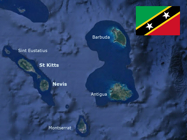
Some of them are at the beginning of their careers, like Ivan and Derrick. These two half-brothers are seventeen, just graduated from high school in Soufriere, St. Lucia. They come in their older brother’s boat, offering to help us with our mooring lines, asking if we need fish or a taxi or a hiking guide. We tell them we are interested in hiking the Pitons, but we need to discuss it with the kids, to come back in an hour. (This strategy works well with pushy salesmen.) In the meantime, we ask the park ranger who comes to take our mooring-ball fee, what does he think about these two boat boys? Are they ok? Is the price they are asking too high? He says they’re good kids, and we might pay more to hire an official park guide because we would also have to pay a driver to get to the trailhead, instead of going by boat and starting on the beach. They seem perfect for our plan: Derrick can take Eli and Aaron up Petit Piton and Ivan can hike Gros with the rest of us. We arrange it when they come back, bearing fresh bread.
They come the next morning at seven to fetch us. They hike in bare feet. They’re quiet, and seem a little shy around our family. I ask lots of questions as I huff and puff up the mountain, curious about their life on the island. Ivan had a chance to go to university, but isn’t ready to go yet. He would rather get paid to hike than go to school, or fish, or farm. After the hike, we offer frozen lemonade and agree to buy some fish their older brother has caught, and invite them to come for fish tacos. We are surprised when they agree. Dinner is subdued, nothing revelatory, but companionable. We talk about career options on the island, because we just can’t believe these two young guys have no other options than to be boat boys. By paying them, we are supporting this idea. I ask what a “good job” on the island would be. Derrick says, predictably, “Doctor.” I ask if they could travel, where would they go? Ivan says, unpredictably, “Miami.” They leave our family dinner to go to a Carnival celebration somewhere on the island, and we leave the next morning.
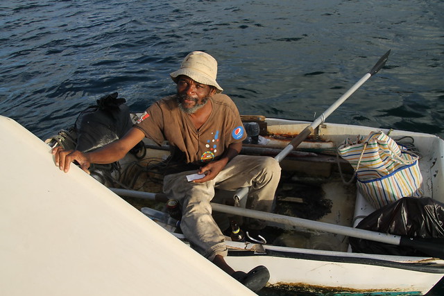
A couple weeks later, while anchored in Tyrell Bay, Carriacou, a man in an ancient rowboat knocks on the side of our boat. Despite the fact that I am the family sucker, I also happen to be the family ambassador, so I always get sent out to talk to the boat boys. And I always come back in with fruits or vegetables, or bracelets, or fish, or bread, or wine, and always a new story. I had just bought limes from a produce stand in Clifton (Union Island in the Grenadines), but Warrior has a bucket of limes and nothing else. He has dark skin, gray hair, and the clearest blue eyes I’ve ever seen on a black man. It gives him an otherworldly look. He offers to take our garbage, but I say no. I bring him a cold drink and buy some limes anyway. I sit down to talk with him. He is incredulous that we have five children on a boat. He says in forty years as a boat boy, he has never met someone traveling with five children. I drag all five kids out on deck and introduce them, and give him a boat card with all our names on it.
I ask him about his years visiting boats. He tells me about the first boat he paddled out to, when he was just fourteen, and its recent return to Carriacou. He tells me about what he does to earn a living, and how he has traveled in years when the money was good, most recently to Grenada for Carnival. I tell him about leaving Atlanta, about rejecting suburban American life for a simpler life on a boat. He asks me what I think about life. I say every day is a gift to unwrap. He says a woman told him once that “life is what you make it.” But he completely rejects this philosophy as he understands it. He says you don’t have power to make anything, but to find it and then do with it what you can. Perhaps it is just semantics, but I think I understand what he is saying. He insists, “Life is not what you make it…it’s how you get it.” He gives examples of historical figures who tried to bend things to their wills but in the end were unsuccessful, like Maurice Bishop in the Grenada Revolution. Ultimately, we don’t have control over circumstances (in Maurice’s case, the treachery of comrades), but over our attitudes, and our willingness to work.
He has more to say, but the sun is sinking into the sea, and he sees that I need to get back to my family. He offers to stop by again, with more produce, and I say I would be happy to talk again if we are still here. I ask if I can take his picture, and shake his weathered hand. As he paddles away, I suddenly think of Ivan and Derrick, and wonder if they will still be doing this in forty years. And I am in no place to judge—maybe this is as good a life as any, taking each day as you find it, interacting with people, offering a service, giving and receiving, and getting out of it what you can.