Category Archives: Recipes

Asking Directions in French

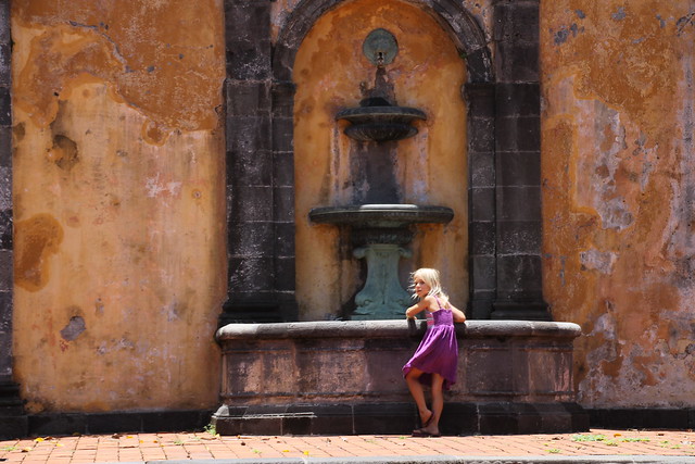
I remember quite clearly the first time I asked for directions in French. I was a sophomore in high school, visiting Quebec with some friends of my parents, Peter and Linda. Linda is French Canadian, and we had struck up a bilingual friendship the previous year when they had come to visit us in Florida. I had taken one year of high school French in a part of the country where a large segment of the population speaks Spanish. As is often the case, one small decision—like which language class to take—leads one down a long and surprising path.

We were in a restaurant in the old city, and I asked for directions to the ladies’ room. Evidently, my ability to ask basic questions surpassed my ability to comprehend the answers, as the hostess responded with a long and very fast explanation involving only a few words of which I caught—something about “stairs” and “to the right.” Too proud to admit my ignorance, I smiled and thanked her and went looking for some “escaliers.” (I eventually found les toilettes.)

Peter and Linda lived in a rural village 20 minutes south of Middlebury, Vermont and that summer visit whetted my appetite for both language immersion and, coincidentally, Middlebury College. Two years later, I found myself conversing awkwardly at the French table in the Middlebury Chateau Language Café, out of my league with students who had had four years of French in prep school and a score of 5 on the French AP exam. Beyond French I and II with my Egyptian teacher, Madame Assaad, at my public high school, the only speaking practice I had had was with the Quebecois on my summer trip and Haitian refugees in my hometown. But after 2 years and a semester abroad at Middlebury’s Paris campus as well as many fun weekends in Montreal, I had even begun to dream in French—the holy grail of language-learners.

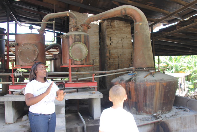
After Middlebury, my opportunities for language practice were only occasional, but often essential. I worked for several years as a teacher in an Atlanta-area public school where my training at Middlebury and my ESOL (English to Speakers of Other Languages) certification were quite helpful. The school was about 80% non-native-English-speakers. Translators for parent-teacher interactions were hard to come by, especially for the Vietnamese students, but lucky for me, and thanks to French colonialism, many of the Vietnamese parents had grown up speaking French in school, so I was able to help find common ground with a group of people who often felt alienated in their new country.

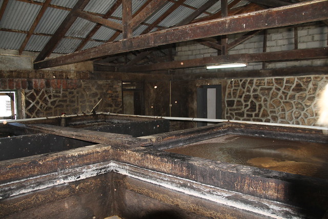
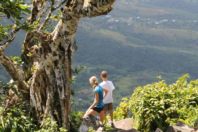
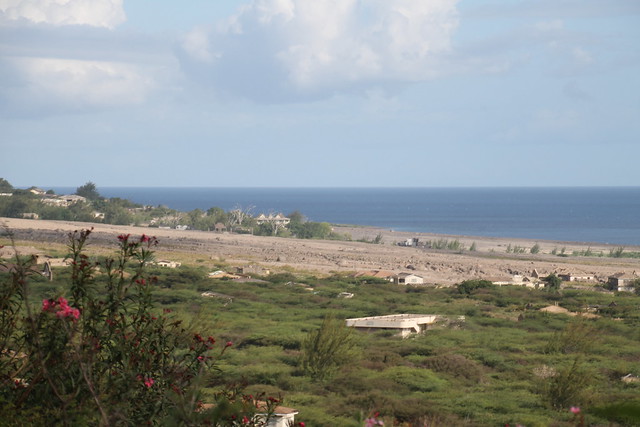
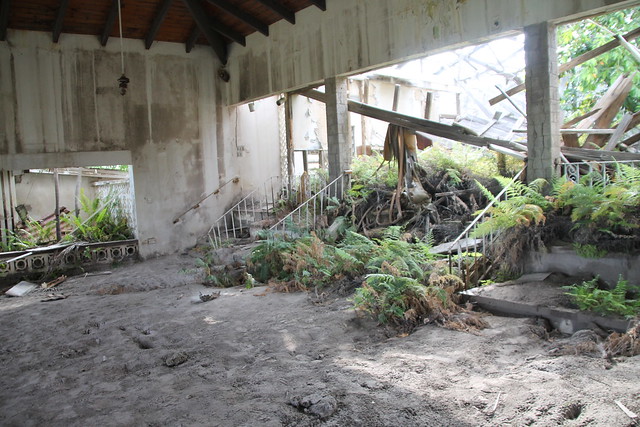
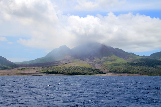
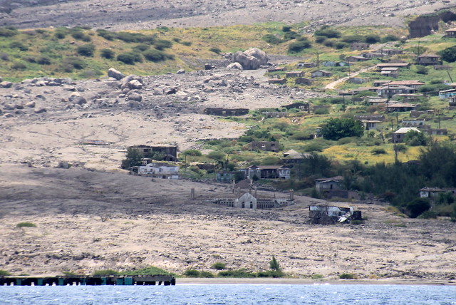
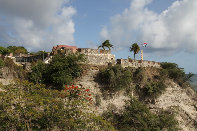
Twenty years have passed since I first asked for directions in French, and though I don’t get many chances to practice, the French language is deeply embedded in my memory. After sailing from Dominica, we anchored near the village of Saint Pierre in Martinique. Jay and I had to locate the café in which to fill out the customs paperwork, the Digicel store to buy a SIM card so we could have internet access, and a bank to withdraw some cash in Euros. A few days later, we took Le Petit Train Tour, which runs all over Saint Pierre, describing its former opulence and showing its devastation by Mt. Pelée; because the tour was in French, I had to act as real-time tour translator for the kids. Somehow, despite twenty years of vocabulary loss and imperfect grammar, I navigated all of these tasks in French, and also found the three things I’d been looking forward to in Martinique: le vin, le pain and le fromage! We even made friends with a French family anchored in Fort-de-France. These experiences make me feel so grateful for Middlebury’s immersion program and the gift of a second tongue. I hope the exposure to French and Spanish in the Caribbean will do for our kids what a visit to Quebec once did for me.

St Pierre, Martinique

Grenada Taxi Tour 

Last week we went on a taxi tour of Grenada. The first stop was Concord Falls. It was a waterfall about 55 feet high. There were stepping stones across the pool below, and then there was another waterfall below that. I am looking forward to swimming there another time.

Concord Falls

Then we went to the nutmeg factory. They process and prepare nutmeg for shipping all over the world.

Nutmeg Processing Plant

Next, we went to the Jouvay Chocolate company. We saw how they sort, roast, grind, melt, and mix chocolate. We got free samples; my favorite was the 60% dark chocolate. We also stopped at Carib’s Leap where the natives jumped off a cliff rather than becoming captives of the French.

Carib's Leap

Last, we saw how they make rum the traditional way at Rivers Rum Distillery. The vats of fermenting cane juice were disgusting!

Antique Equipment

Vats of Fermenting Cane Juice

Rivers Rum Distillery

Finally, we drove back to St. George’s through the Grand Etang Rain Forest, but we did not see any of the Mona Monkeys that live there. It was a long day!

Taking the Heat

It is hot in Grenada. Hot, hot, HOT!  At mid-morning, with the door and windows closed, the temperature in the cabin would be around 99 degrees Fahrenheit. A good breeze brings the temperature within tolerable limits. At anchor, the trade winds provide a consistent source of…well, wind. However, tied to a dock in Port Louis Marina, the breeze is both blocked by a mountain and hitting us at the wrong angle. Cooking only compounds the problem. Unless you were born in the tropics, or the Sahara Desert, you will be unable to function efficiently.

We are pretty tough. Six years ago, we survived a summer in Boot Key Harbor, baked by the relentless sun and besieged by the relentless mosquitoes. We lived through that by spending the heat of the day lounging on the trampolines under a shade tent, doing nothing. Needful to say, now we’re older and have school and chores to do, so lounging all day is no longer a viable solution to our little problem. The frustrating thing is that we do have air conditioners capable of bringing the temperature below 85 degrees, and shore power is available. It’s just very, very expensive; 62 cents per kilowatt hour may not sound like much, but it adds up. We could run the generator all day, but that doesn’t bring the cost down much, and it’s annoying.

Despite the various roadblocks, we are winning the battle against the summer heat. Here are some of our strategies:

  1. Shade awnings. We have four large mesh awnings stretched over the cabin top and foredeck by fiberglass broomsticks, and held taut by a complex web of small-diameter lines. It may seem low-tech, but it really helps lower the temperature.
  2. Ice cream. Every week, when mom goes to the store down the road, she brings back a 1-gallon bucket of ice cream (along with the other groceries, of course). This doesn’t directly help keep the cabin cool, but it raises morale while temporarily lowering the body temperature.
  3. Breeze Boosters. This is a special type of wind scoop that does not require the constant use of a halyard for suspension. We have four, and position them over the bedroom hatches in an attempt to funnel whatever wind there might be in to the boat.
  4. Going to the pool. As a general thing, I do not like pools, and this marina’s pool is no exception. However, sometimes it’s just too hot to object, even if the water is lukewarm, cloudy, and feels like you are swimming in lubricating oil.
  5. A/C. We typically run the generator from 7 to 11 PM, to make water and power, so we also run the air conditioners. This counteracts the added heat from mom cooking dinner, and allows us to go to bed nice and cool (I like my room at a balmy 70 degrees Fahrenheit). We close up the boat, and keep it closed even when the A/C goes off, trying to keep the cold in.
  6. The poor man’s A/C. Take cold shower. Turn on fan. That simple.

If all these methods fail, a visit to the air conditioned marina bathroom, grocery store, or taxi tour will provide some relief until the sun goes down. In the tropics, you have to learn to take the heat.

The Hike Up Gros Piton

In St. Lucia, Mom, Dad, Sarah, Rachel, and I hiked up Gros Piton (peak on the right) while Eli and Aaron climbed Petit Piton (peak on the left).

The Pitons, St Lucia

It was maybe the longest and steepest hike in Sam history. It was steeper than the Quill, but took about the same amount of time. Also this hike had log stairs, which made it harder.

Gros Piton Hike, St Lucia

At the halfway point, we stopped for granola bars. Meanwhile, I saw a bird spying on us in case we dropped any food, so I held out my hand with some granola crumbs in it and the bird hopped down and ate out of my hand.

Bird in the Hand, Gros Piton Hike, St Lucia

It took about two and a half hours to get to the top of the mountain, but getting down was the hard part, because it was raining and the stairs were slippery. I was pretty sore from the hike, but the view was well worth it.

Gros Piton Hike, St Lucia

Ti Piton, Gros Piton Hike, St Lucia

Geography Report: Antigua and Barbuda

AntiguaBarbudaMapFlag

Basic Facts

Capital: St. John, Antigua
People/Customs: The population on Antigua is approximately 65,000, on Barbuda, 1200. About 90% of the population are of African descent, but there are also British and Portuguese roots on the islands.
Language: English
Climate: In the Winter the high is around 81°, the low, 72°. In the Summer, the high is 86°, the low, 77°. Hurricane Season is from June to November.
Food/Farming: There are local fishermen in the waters around Antigua and Barbuda, and banana trees are grown. Due to the plentiful mangoes, a mango festival is held every summer.
Government: Antigua and Barbuda are an independent nation inside the British Commonwealth and have a Prime Minister.
Currency: Antigua and Barbuda use the East Caribbean Dollar.
Art/Music/Culture: Cricket is the most commonly played sport here, and Calypso and Reggae are popular musical styles.

History

Columbus sighted this island in 1493 and named it after a church in Seville, Spain. The British colonized Antigua and grew indigo and tobacco. In 1674 Christopher Codrington established Betty’s Hope, where one still can go to see how sugar cane was processed. Slaves were imported from Africa for work on the plantations and rum distilleries. Barbuda was used mainly for farming food for the slaves. Several fortifications were built around Antigua. The British used Antigua for careening and repairing ships, starting in the 1740’s. Horatio Nelson served a few years in English Harbour; a museum at Nelson’s Dockyard commemorates his time there. By the end of the 18th century the demand for sugar dropped and the economy crashed. Slavery was ended in 1834, and the sugar plantations have been left inoperable since. In 1967 Antigua became an Associated State of the United Kingdom. It won its full independence in 1981. Tourism is now the island’s main industry, with many sailing regattas attracting a large international crowd.

Land forms/Flora and Fauna

One of Antigua’s interesting land forms is a natural bridge, Devil’s Bridge, caused by tides and wave action. The island is volcanic, 108 square miles, and 1319 feet high at the topmost point. Open plains and scrublands are abundant. Antigua also has many white sand beaches, popular with tourists.

Things to do

Kiteboarding, Devil’s Bridge, “365 beaches, one for each day of the year” including the popular Darkwood Beach, Five Islands Harbour, Sailboat Racing, Jungle Zip-line tour, Nelson’s Dockyard and Shirley Heights, Betty’s Hope, Snorkeling, Frigate Bird Sanctuary on Barbuda.

Bibliography

Bendure, Glenda and Ned Friary. “Antigua and Barbuda.” Lonely Planet Guide to the Eastern Caribbean, 2nd Edition. 1998: Lonely Planet, Hawthorn, Australia.

TMF

TMF is family lingo for “Too Much Fun.” This is usually evident after several late nights or long days in the sun when people begin to feel a bit cranky and need a down day. We have had so much fun recently that we have had no time to load new photos and post new blog entries. “Down days” are now quite frequently spent sailing from one island to another, kids passed out on every available cushion. We are in the process of looking through lots of photos and catching up on writing about the places we’ve been, so you may notice some posts from islands we passed a while ago. Our goal is to be in Grenada by the first of August and to have some time to catch up on the school and work that has been on the back burner while we have been having TMF!

Making Lemonade in Montserrat

On the morning of August 3, 1997, Jay and I left the Miami airport for our honeymoon in Mexico. That afternoon, unbeknownst to us, across the Caribbean Sea, a disaster was unfolding on the small volcanic island of Montserrat. Positioned between Nevis to the north and Guadeloupe to the south, it was a vacation paradise, a place where famous musicians like Eric Clapton and Paul McCartney came to record music and relax. It had a picturesque seaside capital. It had 15,000 inhabitants, a medical school, bustling businesses, and farms that exported tropical produce. It also had an awakening giant.

Plymouth, Montserrat

Standing on the hillside above the exclusion zone, it is hard to imagine what Plymouth looked like before the Soufriere Hills volcano eruptions. What little is left between the scars of pyroclastic flow and lahar is buried waist-deep in ash. The skeletal remains of buildings can be seen above the surface of the wasteland, and the hillsides around the old capital are covered in houses slowly rotting as nature takes over in danger zones that were evacuated after a series of eruptions, the most recent in 2010. A hardened crust of new earth fills in the gap where a half-moon beach once curved along the southwestern side of Montserrat. Today the mountain resembles a sleeping dragon with smoke slowly curling from its nostrils and an acrid haze creeping down its back.

Soufriere Hills, Montserrat

Still standing, like lone sentinels, are two sugar mills from plantation days, reminiscent of the faros of Sardinia, ancient stone markers of a history slowly being effaced by powerful erosive and, ironically, creative, forces. A hotel stands on the outskirts, its pool filled with ash and lush growth, only the tiles and a ladder to remind one what it once was. The lobby of the hotel is filled with ash as well, and the roof is caving in, its supports rusting in the sulfurous rain and wind.

Hotel Lobby

Beside us stand two men who look with different eyes—eyes that remember what this place once was. “Here is the dining room,” says Moose, our taxi driver and tour guide. “This was a very popular spot. They used to have barbecues on the weekends.” Cecil had a successful business (he is still a master leather-worker), but now they make a living taking visitors like us on taxi-tours into the zones surrounding the volcano’s exclusion zone, or selling burgers and beers to people who take a day to explore the island. As much as we would like to gawk at this act of God close-up, the two men remind us of the unseen dangers. Entire houses were buried under the pyroclastic flow, and the roofs have dissolved, leaving a crust of ash one might fall through if he went snooping. There are also hefty fines for entering Plymouth, the old capital.

Cecil and Moose

Moose has to drive by his old place every time he takes people to this side of the island. He doesn’t say anything at the time, but later he talks about what if feels like to see his building. It was built to replace his original business in the old city. At the time, the volcano was quiet, and the exclusion zone was small. He was set to open on a Friday, but Wednesday, there was a government announcement, redrawing the lines to protect people, and his property was inside that new line. The village he grew up in no longer exists, wiped off the face of the earth by the volcanic eruptions. To talk to Moose or Cecil, you wouldn’t be able to tell that they are sad about these losses. Moose says the words “positive” and “no problem” so often that I begin to believe them. These are people who lost everything—sometimes twice—and did not flee the island. They continue to rebuild, to smile, and to welcome visitors. It made me feel insensitive to take pictures of their ruined city, but there is another way to look at the situation: if life hands you lemons, you make lemonade. And that is just what Montserrat is trying to do. “We cannot focus on the past,” insists Moose. “We must look to the future.”

That’s a difficult task for an island that lost two-thirds of its usable land to a volcano, ten thousand inhabitants who resettled elsewhere (mostly England and other Caribbean islands), its capital and both the agricultural and tourism segments of its economy, all virtually overnight. Only 19 people died in the eruptions, but the island lost a whole generation; as schools closed or became temporary shelters, families with children left the island to find jobs and stability elsewhere.

But the phoenix rises: Moose has a new restaurant, not far from the government dock where visitors check in with customs and immigration. Cecil pointed out places where the government is preparing to build geothermal power stations. A group of caring recording artists (including such names as Elton John, Sting, Phil Collins, and Mark Knopfler) held a benefit concert in England and the proceeds built a new cultural center, where their handprints, cast in bronze, are on display. A new town is being built in a part of the island that used to be wilderness, and boats are coming back to visit, anchoring in Little Bay to the northwest. And a big draw for the island is the volcano that both put it on and took it off the map.

Soufriere Hills, Montserrat

First stop on the tour is the MVO—Montserrat Volcano Observatory. Here, the volcano is closely watched by scientists, and anyone interested is educated. Every six months, vulcanologists from around the world meet here to discuss the state of volcanic activity and consult with local officials. At a meeting in 2010, the scientists were met with an ash plume as the dozing giant awakened again. Seismographs monitor activity in the earth, and GPS is used to show any subtle changes that may be taking place as the earth expands or contracts over the hot spot beneath the island. The before-and-after photographs on the walls of the MVO leave one breathless and wordless. The only thing more remarkable is seeing the devastation firsthand.

Plymouth, Montserrat

On Statia, one can hike into an extinct volcano, and on Nevis, one can bathe in springs heated by geothermal vents, but Montserrat has a living, breathing volcano, and it is a sight to behold. The island is often overlooked, written off since the disaster, but visitors have both something to offer and to learn. While tourist dollars help rebuild the island and a view of the exclusion zone reveals the destructive power of nature, talking to the locals uncovers an even more amazing phenomenon: the power of a positive attitude.

Bailing Out

We like to have contingency plans. The worst case scenario is usually imagined and planned for, we have backups for backups, and our travel itineraries always identify bailout points.

Yesterday we tried to go from Nevis to Montserrat. The weather we expected was wind from 90 degrees at 15-18 knots gusting to 20. Our only bailout option was a return to Nevis.

Like most catamarans, Take Two just does not sail well to windward. The sails will draw at about 35 degrees apparent wind angle, but we’re slow and make a lot of leeway. Speed reduces leeway. To build speed we have to bear away, but the increased speed brings the apparent wind forward again, so we bear away more. We reach equilibrium at about 60 degrees true, which is the number we use for planning. It’s pretty bad. Then there are the waves… We try not to go upwind.

The course from Nevis to Montserrat is 135 degrees, and with wind from 90 we’d only be able to sail 150, so we knew it would be an uphill battle. But the wind in these parts is seldom far from 90 degrees, it’s just something you have to deal with until you get far enough East. So we went out thinking we would deal with it.

The general strategies available are to sail giant 120-degree tacks that take us far out of our way and back again, to sail as close to the course as we can and then motor directly upwind for the final leg, or to motorsail the course (use the engines to provide the extra power needed to hold us closer to the wind).

NevisMontserrat

Unfortunately, the wind we found was a lot stronger than was forecast, which seriously impeded our desire and ability to make windward progress, even with the engines. Motorsailing wasn’t going to work, sailing off the wind and then motoring upwind was going to be very hard, and tacking upwind would almost double our distance for the day. Once we were well clear of Nevis and confident we were seeing the real wind unaffected by mountains, a decision was needed.

On several occasions, I’ve felt compelled to apologize to the crew after days that were harder than expected. I did not want this to be one of those days. Ahead was a challenging upwind struggle to an uncertain anchorage dominated by an active volcano. Behind us was an easy reach to a calm anchorage with friends, a nice beach, and understanding customs officials. There wasn’t a reason why we had to do the trip that day. So 7 miles into our trip to Montserrat, I pulled the plug and turned us back to Nevis.

We rolled back into Nevis slightly abashed, but smiling. We were not defeated or damaged. So we’ll sit back and relax for a few days, celebrate Midsummer Day with our Swedish friends, and pick our weather more carefully next time.

The name “Take Two” is appropriate because it sometimes takes us two tries to get something right. If the first try doesn’t work out, we usually nail it the second time. But if it doesn’t work the second time, then in the immortal words of Curly, “If at first you don’t succeed, keep on sucking till you do succeed.”

CurlyQuote

Take a Hike

Known as the “Golden Rock of the Caribbean,” St. Eustatius, or Statia for short, was once the busiest trading port in the world. The reason was that the Dutch had turned it into a duty-free port. During the American Revolution, arms and gunpowder were smuggled through Statia to the rebelling colonies. St. Eustatius is a relatively small volcanic island in the Caribbean Netherlands. The island changed hands more than twenty times between the French, British, and Dutch, with the Dutch ending up with it in the end. Apparently everybody wanted it, but not enough to defend it well.

160617_1_6751

The island is about four miles long, with large hills at one end, and a huge volcano called the Quill at the other. “Kuil” in Dutch means “OMG, that’s a big pit!” Fortunately, it has not erupted for thousands of years. Because of the island’s relative roundness, it makes for very rolly anchoring. The official language is Dutch, so of course everybody speaks English. The island economy is dependent on fishing, small businesses, and tourism.

Dad needed to work, so when he and mom went ashore to check in, he bought some internet. They also scoped out the community, and mom bought national park passes to go hiking on the Quill. When they got back, we packed up lunches and waters, and had the usual discussion about which shoes to wear. For me, the choice was easy: sneakers or crocs. Duh.  Mom ate some breakfast, and Dad ferried us over to the island.

As we surmounted the cliff that surrounds most of the island, I noted aloud what a long way away the actual mountain seemed to be. “Oh, it’s only a thirty minute walk” mom answered. Unsurprisingly, “walk” turned out to be an understatement. Our route to the mountain, Rosemary Lane, led in a straight line for what seemed like a mile and a half at a 30 degree incline. Only at the top of this did the actual hike begin.

Rachel almost made it to the top of the lane before complaining that she was tired. Mom managed to cajole her to the beginning of the trail, where we took a short break. After lightening the water-carrier’s load a little, we started the hike to the crater rim in earnest.

The hike was long. Not particularly difficult, just long. The rim trail wound up the mountainside in such a way to make the route feel like it was uphill both ways. The entire mountain was heavily forested, so the view was limited. By limited, I mean nonexistent. There was only one break in the trees, high up on the mountainside. From over 1000 feet, we got a great view of Oranjestad, the only city on the island, and our tiny boat in the harbor. We paused for a moment to enjoy the vista, and then it was back to the ever-steepening trail.

Aaron, Sam and I soon drew ahead of the others. Empowered by handfuls of goldfish crackers, we reached the summit well before everyone else. Our chests heaving, we staggered over to the rocky edge, and looked down into the crater.  Boy, was the view worth the hike. The crater floor almost a thousand feet below us was densely forested. Steep rock walls rose up on all sides to form the rim. Off to sea in the other direction, Saba, another volcanic island, was clearly visible. We ate our lunch while we waited for the others to catch up.

160616_1_6700

When they did eventually reach the top, they were equally impressed. They ate their lunches, and we discussed what to do. Rachel was tired and thirsty, as she had drunk all of her water on the ascent. Aaron and I still had some steam left, so we opted to go down the path into the crater. Mom gave us an hour to explore before we had to come back. She also gave us dad’s nice camera to take pictures of what we saw, but characteristically forgot to show us how to use it. We took our still-half-full water bottles, and descended into the crater. The hike down was short, but steep, in contrast to the relatively gentle slope of the hike to the rim. Ropes were stretched between trees at irregular intervals, to provide support in navigating the treacherous terrain. A dense rainforest filled the crater, with huge trees over 65 feet high. Large boulders lay all around. Thick green moss covered everything, accompanied by the scent of decaying leaves.

We had not been walking long before we came across a simply huge banyan tree. I knew I had to climb it. Aaron plopped the pack down, and sat on a rock and took out the camera. I went over to the tree, and tried to find a route up it. I settled on a thickish vine, and started climbing. Shimmying up the vine in this manner forced me to practically hug the tree. I might add that I had neglected to put my shirt back on after hiking (we were hot). As I write this, I periodically pause to scratch at the itchy rash that has magically appeared all over my chest and arms. Oh well. It was a cool tree anyhow. After about five minutes, I got tired of watching Aaron wrestle with the camera from a height of 30 feet, and came down. We continued down the sparsely marked trail. Once we saw a lone goat cross the path ahead of us. The trail was a loop, so we ended up going back the way we started. We climbed back up the jumbled slope to the others.

They had spent the hour playing with a chicken that had followed us up (and feeding it peanut butter and jelly sandwiches). Rachel was at this point very tired, and making it very well known. I took the time to eat an apple and drink the last of my water. We eventually convinced Rachel that the only way to go home was to go back down the path, and set off. Sarah, Sam, and Aaron soon pulled ahead. I was more tired (yes, even I get tired sometimes), and stayed up at the top to rest and finish my apple. When I was done, I followed Mom and Rachel. Unfortunately, Rachel had decided to wear a dress on the hike, and there were lots of roots across the trail. We’ll just say she fell down a lot.

We noticed nothing new on the trek down. Same trees. Same rocks. Same chickens. And then we reached the road at the foot of the volcano. The walk down Rosemary Lane was arguably worse than the hike. At least on the mountain there was shade and some breeze. The day had started out cloudy, but had turned into a first-rate tropical scorcher. Mom promised ice cream to keep the fainter members of the crew going. Tired and hot, the hardy mountaineers staggered through Oranjestad in search of ice cream. The first place we tried, the Cool Corner sounded likely, but turned out to be a pub. Mazinga’s, however, a gift shop named after the highest peak on the Quill, had a cold-snacks freezer. Mom, true to her word, bought us all an ice cream cone while we waited for dad to pick us up in the dinghy. We had been gone all day, and had had a great time. Anybody who doesn’t believe me can take a hike.

Off the Beaten Path: Anguilla, Statia, and Nevis

One of the things we love about cruising is the virtually limitless options and complete freedom to choose. It’s also one of the hardest things to deal with. Unless you are decisive and have a clear picture of what you want, the questions “Where should we go? When should we leave? How long should we stay?” can circle round and round the chart table. As we travel, we learn our preferences, and as we discover what we love and don’t love, they become guidelines for future travel.

For instance, we have discovered that we don’t love crowded places. It’s one reason why we like to travel in the “off season.” If a cruise ship stops at your port, we will avoid you like the plague. If renting jet-skis is a highlight of your waterfront resort, we shall sail on by. If your beach is rated “#1 in the Caribbean” it is automatically not first in our book, because everyone will flock there to see if it really is the best. So, as we do in every other area of our lives, we choose the road less traveled, and have not regretted it for a moment.

Anguilla, British West Indie

160615_1_6655

Of the ten boats that left Gorda Sound the same day to travel south, ours is the only one that stopped in Anguilla. We had been told that Anguilla was expensive, that it had no support systems for boats (fuel, marinas, chandleries, etc.), and that “no one goes there.” Our ears perked up. We anchored in Road Bay at Sandy Ground, a little white sand beach lined with local boats and beach bars (Roy’s is our favorite). We made friends with a “belonger” who had moved to an Anguillian tax paradise, and had a lovely evening at the restaurant Veya and talked at length with Chef Carrie Bogar and her husband Jerry, who moved to Anguilla from Pennsylvania with their three kids ten years ago to start over. We found the locals to be exceedingly friendly and helpful, and the beaches rivaled those of the Exumas. It is true that Anguilla does not have support systems for boats, and that they have made their cruising fees prohibitively expensive so that the only way to explore the island is by rental car, and it does seem that people pass it up for more popular spots to the south. But it is also beautiful, the restaurants are top-notch (our favorite places were Ripples, Blanchard’s Beach Shack, and Veya), and rental cars and food stores are reasonably-priced. If one doesn’t mind staying overnight in Sandy Ground, Anguilla is not expensive or hard to enjoy.

Sint Eustatius (Statia), Caribbean Netherlands

160616_1_6722

Between St. Martin and St. Kitts, there are two little volcanic islands that poke their heads out of the sea: Saba and Statia. People often skip these two places because they are less accessible, have no beaches, and the anchorages are notoriously uncomfortable due to ocean swells. The wind blew us toward Statia, where we shared the mooring field with one other cruising boat, and had the entire volcano to ourselves the day we hiked. Statia is old-world, charming, and has beautiful natural areas to explore. One or two nights here is enough to get a feel for the place, go for a nice hike, and have a cold drink or an ice cream under an umbrella at Mazinga’s. The anchorage is very rolly, and there is an oil terminal on the northwestern side of the island, but all the same, Statia’s history and national parks make it a worthwhile stop.

Nevis, St. Kitts and Nevis

160618_1_6798

When we checked in at Bassterre, St. Kitts, we really weren’t sure where to go. Neither island had been on our “cruising itinerary,” but we needed a place to stop to wait for weather. I’m sure there are some interesting things to see in St. Kitts, but Basseterre is unattractive and uncomfortable, plus we had to dinghy past a cruise ship to check in, so we were already biased against it. A taxi driver in the crowded cruise ship shopping area attempted to sell us an island tour (right after a jeweler tried to sell us some duty-free diamonds), but we told her we were heading out as soon as possible, probably for Nevis. She said, “No—St. Kitts has more to offer! Nevis is too quiet!” That was all the encouragement we needed. And so we find ourselves in a beautiful place, with new boat friends, enjoying yet another great beach bar, and exploring the amazing history and beautiful natural scenery one finds off the beaten path.