Author Archives: Eli

Taking the Heat

It is hot in Grenada. Hot, hot, HOT!  At mid-morning, with the door and windows closed, the temperature in the cabin would be around 99 degrees Fahrenheit. A good breeze brings the temperature within tolerable limits. At anchor, the trade winds provide a consistent source of…well, wind. However, tied to a dock in Port Louis Marina, the breeze is both blocked by a mountain and hitting us at the wrong angle. Cooking only compounds the problem. Unless you were born in the tropics, or the Sahara Desert, you will be unable to function efficiently.

We are pretty tough. Six years ago, we survived a summer in Boot Key Harbor, baked by the relentless sun and besieged by the relentless mosquitoes. We lived through that by spending the heat of the day lounging on the trampolines under a shade tent, doing nothing. Needful to say, now we’re older and have school and chores to do, so lounging all day is no longer a viable solution to our little problem. The frustrating thing is that we do have air conditioners capable of bringing the temperature below 85 degrees, and shore power is available. It’s just very, very expensive; 62 cents per kilowatt hour may not sound like much, but it adds up. We could run the generator all day, but that doesn’t bring the cost down much, and it’s annoying.

Despite the various roadblocks, we are winning the battle against the summer heat. Here are some of our strategies:

  1. Shade awnings. We have four large mesh awnings stretched over the cabin top and foredeck by fiberglass broomsticks, and held taut by a complex web of small-diameter lines. It may seem low-tech, but it really helps lower the temperature.
  2. Ice cream. Every week, when mom goes to the store down the road, she brings back a 1-gallon bucket of ice cream (along with the other groceries, of course). This doesn’t directly help keep the cabin cool, but it raises morale while temporarily lowering the body temperature.
  3. Breeze Boosters. This is a special type of wind scoop that does not require the constant use of a halyard for suspension. We have four, and position them over the bedroom hatches in an attempt to funnel whatever wind there might be in to the boat.
  4. Going to the pool. As a general thing, I do not like pools, and this marina’s pool is no exception. However, sometimes it’s just too hot to object, even if the water is lukewarm, cloudy, and feels like you are swimming in lubricating oil.
  5. A/C. We typically run the generator from 7 to 11 PM, to make water and power, so we also run the air conditioners. This counteracts the added heat from mom cooking dinner, and allows us to go to bed nice and cool (I like my room at a balmy 70 degrees Fahrenheit). We close up the boat, and keep it closed even when the A/C goes off, trying to keep the cold in.
  6. The poor man’s A/C. Take cold shower. Turn on fan. That simple.

If all these methods fail, a visit to the air conditioned marina bathroom, grocery store, or taxi tour will provide some relief until the sun goes down. In the tropics, you have to learn to take the heat.

Boiling Lake, Dominica

One of the reasons we stopped in Dominica, “the Nature Island,” was to do some hiking. We knew that Dominica had a boiling lake up in the volcanic mountains, and thought it sounded cool. However, it could only be reached by a steep 16-mile hike over rough terrain. Despite this, and the six-hour time limit, Mom, Aaron, Sarah, and I still wanted to go. Dad stayed home to work and keep an eye on Sam and Rachel, whose legs are too short for such a long hike.

Several days before, Mom had purchased a National Parks Pass, which was required to go hiking anywhere in Dominica. We also required a guide to help us navigate the somewhat-confusing paths, a driver to take us to the capital city of Roseau and up to the beginning of the hike, and an alarm clock to help us get up at 6 o’clock in the morning to start the day-long journey. I am typically a late-riser, so hauling my butt out of bed at such an early hour was tortuous. We then ate a quick breakfast and packed lunch, snacks, and water into three backpacks. We were then picked up and ferried ashore by a ‘boat boy’.

The boat boys are a gang of local men in small dinghies and paddle boards, armed to the teeth with fresh produce, and whose only purpose in life seems to be to cater to cruisers. They, among other things, brought fresh fruit to your boat, helped get you around town and plan expeditions, and also gave good river tours. They also served as a water taxi.

We were met at the dock by two local guys: our driver for the day, Anselm, and our trail guide, Francis. We got into the van, and took off. The drive to Roseau was a little over an hour long, and Anselm was apparently very comfortable at high speed, even on the twisty mountain roads. And all the while, Francis gave a running commentary on the history of the surrounding scenery.

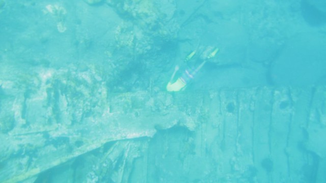
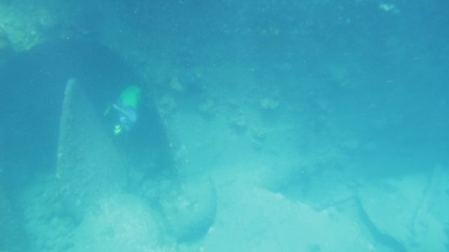
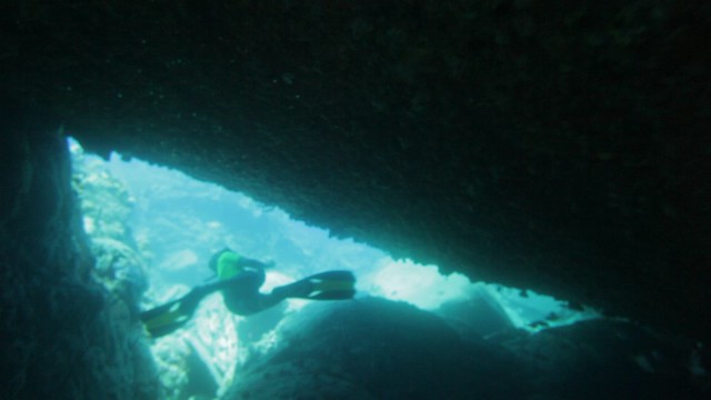
The road ended where the hike began: at Titou Gorge. Titou Gorge is, well, a gorge. It sits right next to the beginning of the path, and the Trois Pitons River runs out of the mouth. Before it flows on down the valley, it forms a large shallow pool. Francis told us that it was possible to swim over a hundred feet back into the gorge to a waterfall, whose waters come from a fresh mountain lake several miles away. It sounded fun, even though the water was bitter cold and the average depth was 15 feet. After a short potty break, we hefted our packs, and set off after the guide into the jungle.

Boiling Lake Hike, Dominica

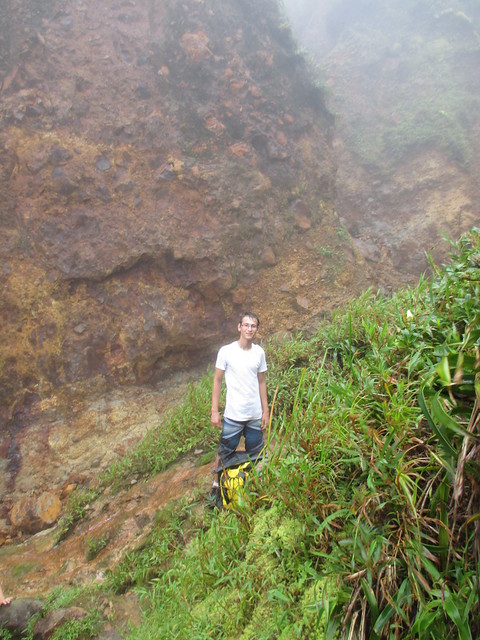
Each leg of the hike was entirely different. The first few miles were through lush, wet jungle. The slope was gentle, and water constantly dripped from the leafy canopy overhead, turning the dirt between the stair steps to mud. Everything was either green, like the leaves, or brown, like the mud. Occasionally, we had to cross cold mountain streams that ran across the path. We took the opportunity to refill our water bottles at a mountain spring bubbling out of the rock.

And then there were the stairs. More stairs than you can count. All up and down the mountains, somebody (or more likely several hundred somebodies) had secured split logs across the trail to form crude stair-steps. Francis assured us that the muddy and sometimes slippery steps were a considerable improvement over past years before the trail was maintained by the national parks system. Judging by the difficulty of some parts of hike, even with the stairs, the steeper areas must have been all but impassable.

The next part of the trek was much steeper. The trail wandered up the side of the second-tallest peak in the Morne Trois Pitons National Park, and so did we. Even on a nice day, the Pitons are usually blanketed in clouds, and this was not a nice day. As we hiked along a narrow ridge, I drew ahead of the others. Off to either side, the no-doubt astounding view was obscured by blowing clouds. Occasionally, as I took a short rest between flights of stairs, I could see snatches of another mountainside off to my left. The blowing mist had another effect: to fog up my glasses. Q: What do you get when you try and clean foggy glasses on a dirty shirt? A: Muddy glasses.

We took a break to eat some snacks at the top of the mountain (we assumed that it was the top of the mountain, because there were no more stairs leading up). Frances said that you could see the entire island from this vantage point, but all we could see was white, white, white. We were half way to the boiling lake, and we were a bit behind schedule. Francis had brought a thermos of ‘cocoa tea’, tea made from roasted cacao beans, sugar, and milk; in other words, home-made hot chocolate. He shared some with us.

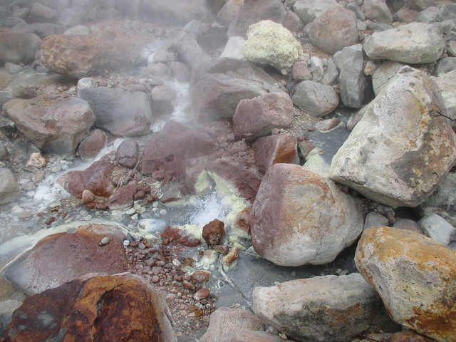
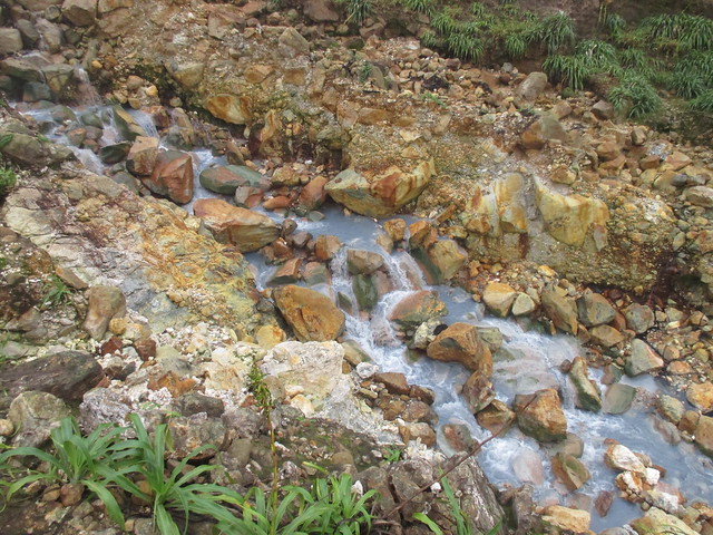
Step three of the journey led us down the other side of the peak, and into the Valley of Desolation. It was very desolate. The rocks wore an odd mixture of colors, from white to yellow, and even green. As we carefully clambered down the rocky trail, we passed a cold spring, a hot spring, and a really hot spring. In several places, steam jetted out of invisible cracks in the rocks, adding to the freakishness of the landscape.

Valley of Desolation, Dominica

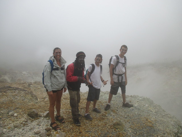
Francis found some white clay, and painted all of our faces (including his own) with intricate patterns. We spotted some lost French tourists that had apparently been too cheap to hire a guide. They asked Francis for directions to the Boiling Lake. Francis said that they could travel with us if they each paid him $50EC (about $20US). They grudgingly paid the bill, and we moved on.

Francis, Boiling Lake Hike, Dominica

Boiling Lake Hike, Dominica

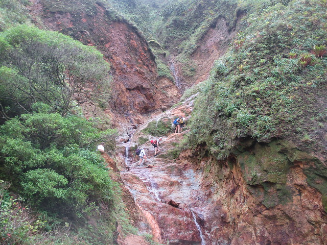
The next and last leg of the expedition was somewhere between a hike and a climb. We gasped our way up several flights of stairs through more jungle, and scrambled up short cliffs and across lukewarm rivers trying not to get any more water in our already-soggy hiking shoes. We also passed a series of warm waterfalls and pools that our guide said we would go swimming in on our way back. Sarah, Aaron, and I drew ahead of everyone else, and so, after climbing up one last hillside, we reached the boiling lake first.

We were standing at the top of a cliff, with mountain behind us, and boiling lake before us. We wearily set our packs down by a rock, and went over to the edge to finally glimpse our objective. We heard faint bubbling noises coming from below, but we could see absolutely nothing through thick layer of mist–or was that steam? Several minutes later, Mom and the French people caught up, with Francis bringing up the rear. We sat on some handy rocks and ate our lunches. Francis was just making himself a special cigarette with “all natural smoking weed” when a soft breeze wafted away the steam cloud, revealing the lake in all its glory.

Boiling Lake, Dominica

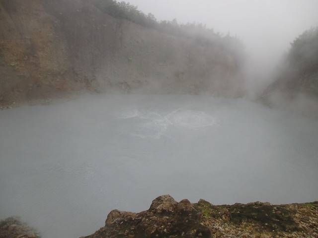
It was surrounded on all sides by cliffs, except where a small stream ran out. The lake was about a hundred feet across, and an eerie milky bluish-gray color. And it actually was boiling. Right in the middle of the lake, the water bubbled and frothed like a pot on a stove, and steam rose from the surface of the water. A couple from Martinique, who had reached the lake before us, asked Francis if it was possible to go swimming in it. Francis asked them if they were out of their minds. We stayed by the lake for almost 45 minutes, enjoying the view and eating the last of the snacks, but when the fog rolled back in, we shouldered our packs, and started the long way back.

Boiling Lake Hike, Dominica

After about thirty minutes of steep jungle, we arrived at the hot waterfalls. We had been hiking in our bathing suits, so we just set down our packs, took off our muddy shoes, and climbed down into the pool at the base of the fall. It was so relaxing to sit in the warm rush of water cascading down the yellow rock after a long, damp hike. We washed off our war paint in the water, and generally enjoyed ourselves. But all good things must come to an end, and this was no exception. After ten minutes of sitting in the waterfall, we had to climb back out and put our shoes and packs back on, and get moving. And boy, was that wind cold.

The hike back through the Valley of Desolation was just as cool as the first time. If you listened closely, you could hear bubbling and boiling noises coming from underneath your feet. If the climb down from the peak was tough on the way down, the climb up was agonizing. Mom and the French people soon lagged far behind, with Francis staying with the stragglers. Aaron, Sarah and I waited up at the top for them, and when they eventually caught up, we started down. The trek through the jungle was longer than I remembered, but again, on the way up we weren’t extremely tired. About halfway down, it started to rain, but we didn’t mind. We stomped in the mud puddles that formed between the steps, trying to splash each other’s legs.

Tired, wet, and muddy, we eventually reached the bottom of the trail. We laid down our packs, and sat on a bench to wait for Mom and Francis. When they arrived, Mom joined us on the bench, and Francis went over to a small café. We went for a brisk swim in the ice-cold water of Titou Gorge, then we wearily lugged our packs for the last time the short distance to the van, where we were joined by Francis. I was so tired that I almost fell asleep on the way home, despite Anselm’s erratic driving. Back in Portsmouth, a boat boy ferried us back to Take Two. We were immediately accosted by the kids that had stayed home, asking all about our adventure. The day ended with warm showers, hot soup, and a good sleep.

Take a Hike

Known as the “Golden Rock of the Caribbean,” St. Eustatius, or Statia for short, was once the busiest trading port in the world. The reason was that the Dutch had turned it into a duty-free port. During the American Revolution, arms and gunpowder were smuggled through Statia to the rebelling colonies. St. Eustatius is a relatively small volcanic island in the Caribbean Netherlands. The island changed hands more than twenty times between the French, British, and Dutch, with the Dutch ending up with it in the end. Apparently everybody wanted it, but not enough to defend it well.

160617_1_6751

The island is about four miles long, with large hills at one end, and a huge volcano called the Quill at the other. “Kuil” in Dutch means “OMG, that’s a big pit!” Fortunately, it has not erupted for thousands of years. Because of the island’s relative roundness, it makes for very rolly anchoring. The official language is Dutch, so of course everybody speaks English. The island economy is dependent on fishing, small businesses, and tourism.

Dad needed to work, so when he and mom went ashore to check in, he bought some internet. They also scoped out the community, and mom bought national park passes to go hiking on the Quill. When they got back, we packed up lunches and waters, and had the usual discussion about which shoes to wear. For me, the choice was easy: sneakers or crocs. Duh.  Mom ate some breakfast, and Dad ferried us over to the island.

As we surmounted the cliff that surrounds most of the island, I noted aloud what a long way away the actual mountain seemed to be. “Oh, it’s only a thirty minute walk” mom answered. Unsurprisingly, “walk” turned out to be an understatement. Our route to the mountain, Rosemary Lane, led in a straight line for what seemed like a mile and a half at a 30 degree incline. Only at the top of this did the actual hike begin.

Rachel almost made it to the top of the lane before complaining that she was tired. Mom managed to cajole her to the beginning of the trail, where we took a short break. After lightening the water-carrier’s load a little, we started the hike to the crater rim in earnest.

The hike was long. Not particularly difficult, just long. The rim trail wound up the mountainside in such a way to make the route feel like it was uphill both ways. The entire mountain was heavily forested, so the view was limited. By limited, I mean nonexistent. There was only one break in the trees, high up on the mountainside. From over 1000 feet, we got a great view of Oranjestad, the only city on the island, and our tiny boat in the harbor. We paused for a moment to enjoy the vista, and then it was back to the ever-steepening trail.

Aaron, Sam and I soon drew ahead of the others. Empowered by handfuls of goldfish crackers, we reached the summit well before everyone else. Our chests heaving, we staggered over to the rocky edge, and looked down into the crater.  Boy, was the view worth the hike. The crater floor almost a thousand feet below us was densely forested. Steep rock walls rose up on all sides to form the rim. Off to sea in the other direction, Saba, another volcanic island, was clearly visible. We ate our lunch while we waited for the others to catch up.

160616_1_6700

When they did eventually reach the top, they were equally impressed. They ate their lunches, and we discussed what to do. Rachel was tired and thirsty, as she had drunk all of her water on the ascent. Aaron and I still had some steam left, so we opted to go down the path into the crater. Mom gave us an hour to explore before we had to come back. She also gave us dad’s nice camera to take pictures of what we saw, but characteristically forgot to show us how to use it. We took our still-half-full water bottles, and descended into the crater. The hike down was short, but steep, in contrast to the relatively gentle slope of the hike to the rim. Ropes were stretched between trees at irregular intervals, to provide support in navigating the treacherous terrain. A dense rainforest filled the crater, with huge trees over 65 feet high. Large boulders lay all around. Thick green moss covered everything, accompanied by the scent of decaying leaves.

We had not been walking long before we came across a simply huge banyan tree. I knew I had to climb it. Aaron plopped the pack down, and sat on a rock and took out the camera. I went over to the tree, and tried to find a route up it. I settled on a thickish vine, and started climbing. Shimmying up the vine in this manner forced me to practically hug the tree. I might add that I had neglected to put my shirt back on after hiking (we were hot). As I write this, I periodically pause to scratch at the itchy rash that has magically appeared all over my chest and arms. Oh well. It was a cool tree anyhow. After about five minutes, I got tired of watching Aaron wrestle with the camera from a height of 30 feet, and came down. We continued down the sparsely marked trail. Once we saw a lone goat cross the path ahead of us. The trail was a loop, so we ended up going back the way we started. We climbed back up the jumbled slope to the others.

They had spent the hour playing with a chicken that had followed us up (and feeding it peanut butter and jelly sandwiches). Rachel was at this point very tired, and making it very well known. I took the time to eat an apple and drink the last of my water. We eventually convinced Rachel that the only way to go home was to go back down the path, and set off. Sarah, Sam, and Aaron soon pulled ahead. I was more tired (yes, even I get tired sometimes), and stayed up at the top to rest and finish my apple. When I was done, I followed Mom and Rachel. Unfortunately, Rachel had decided to wear a dress on the hike, and there were lots of roots across the trail. We’ll just say she fell down a lot.

We noticed nothing new on the trek down. Same trees. Same rocks. Same chickens. And then we reached the road at the foot of the volcano. The walk down Rosemary Lane was arguably worse than the hike. At least on the mountain there was shade and some breeze. The day had started out cloudy, but had turned into a first-rate tropical scorcher. Mom promised ice cream to keep the fainter members of the crew going. Tired and hot, the hardy mountaineers staggered through Oranjestad in search of ice cream. The first place we tried, the Cool Corner sounded likely, but turned out to be a pub. Mazinga’s, however, a gift shop named after the highest peak on the Quill, had a cold-snacks freezer. Mom, true to her word, bought us all an ice cream cone while we waited for dad to pick us up in the dinghy. We had been gone all day, and had had a great time. Anybody who doesn’t believe me can take a hike.

The Wreck of the Rhone

Over the course of our family’s snorkeling career, we have dived on the wrecks of several planes and ships. The most recent of these is the wreck of the RMS Rhone. The Royal Mail Ship Rhone sank off of Salt Island, BVI, in 1868 during a hurricane. Another mail ship, the Conway, also sank in Drake Chanel in the same hurricane.

As it sank, the metal steamship broke into two sections. The bow section fell in 80 feet of water, and is largely intact. The stern section sank closer to shore, in 25 to 70 feet of water, and broke into even more chunks. The largest piece, the very rear of the ship, is in 30 to 45 feet. Clearly visible in the wreckage is the gear box, drive shaft, rudder, and huge bronze propeller.

We were anchored nearby, and decided to check it out. We dinghied out to the wreck, laden with snorkel gear, and tied up at one of the numerous moorings over the area. We were joined by some friends on Abby Singer, who also wanted to see the wreck. We swam towards the buoy, looking for the debris of the sunken ship. We found nothing but rocks and a school of squid. It wasn’t until an enterprising young diver (me) decided to search in the other direction, did we find the stern chunk.

I made several dives over the main section, looking for the captain’s silver tea spoon, which was, according to our diving guide, resting on the gearbox. Unfortunately, I never found it, but I did find a large number of colorful corals and reef fish. I swam on to view other pieces of the wreckage, including the ship’s disco (with checkered tile floor intact), and the engine. The side of the engine was laid bare, revealing the barnacle-encrusted crankshaft and pistons as large as myself. It was weird to imagine that these rusted and overgrown pieces of machinery once operated smoothly.

The coolest thing though, was the prop cavity. Twenty feet deep, the area where the broken propeller used to spin left a cave that led under the hull and out the other side. The inside was coated in a dense layer of multi-colored sponges. There were also large schools of little brown fish with forked tails and bulging eyes, and five or six grouper.

I swam down and inspected it, weighing my odds of success if I went through. It wasn’t that far to the other side, only 15 feet or so, an easy distance (for me). But what if I can’t hold my breath long enough… Nah, I’ll be fine. I swam in. It was weird, the minute I went underneath the hull, the urge to breathe lessened, allowing me to leisurely swim through the prop cavity and up to the surface. I made several such dives. I don’t know why it’s so fun to swim under things, but I sure get a kick out of it!

The next day, Andrew on Abby Singer and I went back to the wreck, him because he wanted to get video footage of the ship, and me because I always want to go snorkeling. I swam through the tunnel a few times, and once again searched in vain for the Mystic Spoon. This second trip to the wreck no-doubt contributed to my advanced condition of TMF (Too Much Fun), but it was so worth it. The Rhone was even better the second time! Visiting it was one of the coolest snorkeling trips ever.

Rhone 1

Rhone 2

Rhone 3

Rhone 4

Rhone 5

Bio Bay

We have finally left Palmas del Mar marina in Puerto Rico, where we had been staying for the last three weeks. We took the first weather window after ten days of rain and squalls to motor to Vieques in the nearby Spanish Virgin Islands. The passage was rough, but fortunately short, only a few hours long. We dropped anchor in a creek leading to Puerto Mosquito, also called Bio Bay (so called because it is supposedly the bioluminescent capital of the world).

We waited until the night was sufficiently black, and then kayaked down the creek into the bay. Even in the creek, our paddle strokes created small swirls of light. Pretty good by our standards, but that was nothing, nothing, compared to what we found inside the bay. It was like we had crossed a magic line. The minute we entered the bay, the bioluminescence was multiplied a million-fold. The slightest motion evinced huge scintillating clouds of green light. It was most excellent.

I was dared by a certain reader to do two things: to jump into La Mina falls in El Yunque rain forest (man, that water was cold), and to swim in Bio Bay. We have now done both. Needless to say, I was the first one in the water. Despite what I expected, it was not creepy to slide into the pitch black water, but exhilarating. Each movement turned the water around me into green fire.

During the day, Puerto Mosquito is calm, shallow, and very murky. In other words, it’s your typical mangrove bay. The bay provides sanctuary for a number of species, such as pelicans, snook, mullet, mangrove cuckoo, herons, and rays. But by far the most well-known inhabitant of Bio Bay is Pyrodinium bahamense. It is a unicellular plankton with two whip-like tails, called flagella, that aid in movement. When agitated, this tiny life form emits a bright green flash of light, creating the glow in the water known as bioluminescence.

We have noticed bioluminescence in our wake before, but never in this volume. The reason for this concentration of glowing dinoflagellates results from several factors, which have conspired to create the perfect environment. Such factors include salinity, water depth and temperature, solar radiation, and slow circulation. The underwater fireflies have taken advantage of these perfect conditions, and multiplied. There are over 600,000 organisms in just one gallon of water.

After swimming for almost an hour, we got back in the kayaks, and paddled slowly home, some of the bioluminescence still clinging to our skin. It was one of the coolest experiences we have had on this trip, and certainly was the best night swim ever!

A New Low

We have just arrived in Puerto Rico from George Town after a seven-day passage. It was our longest uninterrupted stretch at sea. We supposedly had excellent weather conditions for a passage east and south, conditions that would not be repeated all season, so we decided to skip the out-islands of the southern Bahamas, the Turks and Caicos, and the Dominican Republic and go straight to Puerto Rico. We also skipped the Mona Passage, the Thorny Path, and days of bashing east into trade winds—the only reason we could do this is because a big ole’ cold front cleared out the trade winds for a couple of days. We left George Town on Thursday afternoon, fervently hoping for a calm, uneventful passage.

It turns out that it wasn’t just a quick sail over flat water. The “light and variable breeze” created confused waves three-to-six feet high, and about six seconds apart. Every time a wave hit the bottom of the bridge-deck, the floor of the main cabin between the hulls, water would be forced volcanically up the scuppers in the cockpit, splashing whoever happened to be standing near them. The entire crew, including me, felt a little queasy. Even mom, who holds the second-least-seasick title, could barely fix up Ramen Noodles and Thrive instant meals. Rachel stubbornly refuses to take seasickness medication, on the grounds that it tastes bad, and makes her barf. Hence, she is often seasick for the first few days of a passage.

For most of our grand voyage, the cabin looked like the interior of an opium den, with kids lying on piles of cushions and blankets like giant lethargic slugs, moaning piteously, and moving only to imbibe water and to obey the call of nature. After the first day, I got over whatever queasiness I had, and made the most of what was sure to be a long and tedious journey. That meant that I played video games. Lots and lots of video games. When I wasn’t crashing sophisticated aircraft, I spent my time reading, composing this blog post, and fetching stuff from down-stairs and helping mom with chores. That’s the only down side of not getting seasick: you get to be the gopher. I can’t really complain. Most people don’t require much on a long trip—they get pillows, blankets, and books, crash on the couch, and sleep on-and-off all day.

Mom and Dad took turns taking night watches, and slept as much as they could during the day. On most nights, I would let Mom take a nap while I took the first two hours of the night watch, from eight to ten. If it was calm, we would watch a movie together before I went to bed. If not, then I would head to bed in my cabin, where I would be tossed around like a salad. Sleeping in heavy seas is somewhat difficult; it feels like somebody is messing with the gravity controls.

One night, after Mom and I finished watching Ferris Bueller’s Day Off, we decided to go out on deck at midnight to have a look around. The seas had finally calmed down, and the wind had all but disappeared. The moon had just set, and, except for the occasional swell, the sea was flat calm. We looked down into the water. There, clearly visible to a depth of twenty feet, were thousands and thousands of bio-luminescent creatures. The depths were alive with glowing, flashing, blue-green stars. Our wake looked like the credits of Star Trek.

Looking up, we saw the Southern Cross, a constellation made up of four stars that are not observable from higher latitudes. Also visible in the northern sky was the Big and Little Dipper, and the North Star. We stood and stared, acutely conscious that with each passing moment, our trusty vessel carried us further south than we had ever been. We had literally reached a new low.

Holding My Breath

I can hold my breath for a long time—almost four minutes. That is, in the comfort of my bed, lying motionless, with up to a minute of hyperventilation beforehand. Even so, not breathing for three minutes and forty-five seconds is a rather impressive feat. (Ah, the happy hours I’ve spent, tucked away in my room with my stopwatch!) It usually takes several  tries to bring my breath-hold up to this level, and once I do, I usually stop (you have no idea how boring it is to sit and do absolutely nothing for three minutes).

When I started practicing my breath-hold, we were about to leave for the Bahamas, and planned to do plenty of spearfishing. I thought I was ready. I thought “bring it on, fish.” Yeah! No. The first time we went swimming off the boat, I took my watch to see how long I could hold my breath immersed in actual water. After hyperventilating for ten seconds, I managed to remain underwater for all of…drumroll…eighteen seconds. Pathetic.

We have been in the Bahamas for a month now, and we are still swimming off the boat. I take this time to practice my breath hold. It takes several tries, but I can get it up to one minute and twenty seconds. I also wear a ridiculously heavy weight belt that we happen to have for no particular reason. It feels really cool to stand on the sandy bottom, looking up at the waves eight feet above you, and not feel the need to breathe.

One day, while standing on the bottom, I had a brilliant idea.  I took a beach chair, weighed it down with weight belts, and set it next to the anchor. Then I took an empty kindle case and a coffee mug and set them on the chair. Then came the hard part. I took a deep breath, dove down, and sat in the chair. Then I had to put a weight belt in my lap to keep me from floating away, pick up the coffee mug and ‘book,’ cross my legs, and pretend to read normally. Meanwhile, Aaron, whose breath-hold isn’t worth jack, had to swim down and take a picture of me with the GoPro, all before I ran out of air. Amazingly enough, my plan worked! We got several pictures of me, relaxing at the bottom of the sea.

Deep Reading

On Lobster, Lion fish, and the Land and Sea Park

The lobster in this place are wondrously large and virile. The natives hath given us a number of them, and my men are most excited to learn the ways of catching them.”  So wrote Christopher Columbus in 1492, during his sojourn in the Bahamas, or so he would have written if he had known what a lobster was, and if the natives had given him any. The lobster in the Bahamas, at least in my experience, certainly are large and virile, if scarce near populated areas. Lobster season lasts until the end of March, and we plan to make the most of it.

We do not have the traditional lobster hunting implements (hand net, tickle stick), but we do have pole spears. And, fortunately, you are allowed to spear lobster in the Bahamas. This adds the complication of having to kill the lobster before measuring it (its carapace must be at least three inches), but I haven’t had too much trouble. All the lobster I’ve seen were well over the size limit. Many of you no doubt think spearing lobster is cheating. While I agree in principle, the pole spear gives us the advantage of flexibility. With a net and tickle stick, you can only hunt lobster. With a spear, you can hunt anything. At least we’re not fishing with hand grenades!

Langosta Killa

Lion fish are also excellent for spear fishing, for a number of reasons. First, they’re instantly identifiable. Second, they’re slow moving–an easy target. Third, there is no minimum length; you don’t have to worry about shooting one that’s too small. Fourth, they’re delicious. Just remove the venomous spines before eating. And fifth, there is no bag limit. Fire away!  The Lion Fish Epidemic started when people set their pet lion fish free in the Atlantic Ocean, far from their natural Pacific predators. The invasive lion fish thrived in their new environment, gobbling up baby reef fish, and multiplying like crazy. Eating them does everyone a favor.

Lionfish

The Exumas Land and Sea Park is a large tract of islands stretching from Shroud Cay to Rocky Dundas. It contains a number of pristine beaches, coral reefs, and, except for a few movie-star-owned islands and the park headquarters, is uninhabited. You are not allowed to take anything out of the park, but this is mostly left to the discretion of the visitors. You’re also not permitted to fish, hunt, or lobster in the park, although enforcement is difficult because of the park’s large boundaries. However, it must be working, because while snorkeling at Warderick Wells, I saw at least six huge lobster hiding under coral heads. I also saw just as many lion fish, more than I’ve ever seen on one reef. This may be another result of the no fishing policy. You would think that killing lion fish, even in the park, would be a public service, right? At least people are respecting the no-take policy. The park is doing something about the lion fish. When I reported sighting a lion fish in a creek to one of the rangers, he said he would take care of it.  When we moved out of the park, I noticed a severe lack of edible sea life, evidence of fishing. I hope that visitors to the Exumas are supplementing their diet of lobster with lion fish!

The Island of the Overpriced Landing Fee

Highborne Cay is a big H-shaped island in the northern Exumas. It is also entirely owned by the Highborne Cay Resort and Marina, meaning you can’t land there without permission. We anchored there last Monday. Dad needed the internet for work, and we wanted to explore, as we had never been ashore there. And for good reason too, as we found out when Mom dinghied over to the marina. The landing fee for non-marina patrons was $25 per person (that’s $150 for the six of us)! However, if you pay the fee, you get access to all the resort facilities (bikes, Hobie cats, beaches, kayaks, bathrooms, etc.).

Despite the cost, we all (dad excluded) decided to land. After paying the (exorbitant) landing fee at the Ship’s Store, we headed out to get some bikes. The bike rack looked like someone had gone into the bike section at Walmart, bought six or seven bikes at random, and let them sit for several months in a humid environment. In spite of appearances, they were in good working order.

I opted not to ride, and instead walked with Mom and short-legs (Rachel), while the others biked on ahead. I soon tired of walking at Rachel’s slow pace, and went exploring. Before long, I saw a side road named “The Spring”. Interested, I decided to follow it. I knew there was some fresh water in the Bahamas (otherwise, how would the Taino Indians have survived?), but I didn’t know about Highborne. The road led down the hill to the beach off of which our boat was anchored. I followed the periodically-spaced signs advertising “SPRING” into the woods. And there it was. The Spring of Highborne Cay: a three-foot-long metal spring hanging from a tree. Disappointed, but not surprised, I returned to the beach. After carving my name in BIG letters in the sand, I went to find the others.

We spent the rest of the day climbing on the rocks on the shoreline, picnicking, biking on the trails, playing basketball at the “basketball court”–a post with a board and hoop nailed to it–and eating over-priced ice cream from the Ship’s Store. Late that afternoon, we went back to the boat, feeling like we had gotten our money’s worth.

Highbourne Swing

Rachel on the swing at Highborne Cay

Crossing the Gulf Stream


Long, over-night passages like crossing the Gulf Stream are, for me, cause for celebration. With the other kids conveniently sea-sick and incapacitated, I can do whatever I feel like. I have (fortunately) never (so far) been afflicted with sea sickness, air sickness, space sickness, or motion sickness of any kind. Even so, three-to-five-foot seas severely limit what I feel like doing. During long passages, I mainly spend my time in my cabin reading science-fiction (currently 2010 Odyssey 2), sitting in the captain’s chair doing nothing, or playing video games. What better way to appreciate Mom’s decree that there will be no school on passages, than to spend uninterrupted hours in front of a screen flying F-15s and driving T-90s? With no competition for the computer, and Mom safely napping off-watch, I get to play as long as I want.

This time was no exception, even though the seas were more like two-to-four-feet. As usual, we attempted to catch some kind of fish, and, as usual, we failed miserably. After the sun went down, Aaron and I kept Mom company while she was on watch. Being on watch is easy. All you have to do is make sure the autopilot doesn’t hit anything. Also, don’t fall asleep. The penalty for sleeping on watch is public flogging, or hanging, depending on whether the autopilot hits anything. Nah, not really.

The next day was more of the same, although Sam overcame his seasickness enough to provide competition for the computer. That evening we watched a movie. We watched Captain Ron instead of carrying on the tradition of watching The Swiss Family Robinson on night passages (although why we would want to watch a movie about a shipwreck is anyone’s guess).  Except for a light rain, the night was uneventful.

The next morning, I woke up and we weren’t underway. We had anchored at Chub Cay to check in to the Bahamas. I was also late to breakfast. Again. While we ate, Dad dinghied ashore to check us in. A few minutes later, he returned. It turned out that we needed to take the boat to the dock for some reason. It also turned out that we had to pay $100 check-in fee, or buy $100 worth of fuel. It seems like a ridiculous trade, but we didn’t mind. We got the fuel. We then proceeded to do nothing for the rest of the day, while we waited for good weather. The next morning, we weighed anchor for Highborne Cay, or the Island of the Over-Priced Landing Fee (coming soon to a blog near you).